News in Pictures / Slow-Moving Typhoon Shanshan Wreaks Havoc Across Wide Swath of Japan
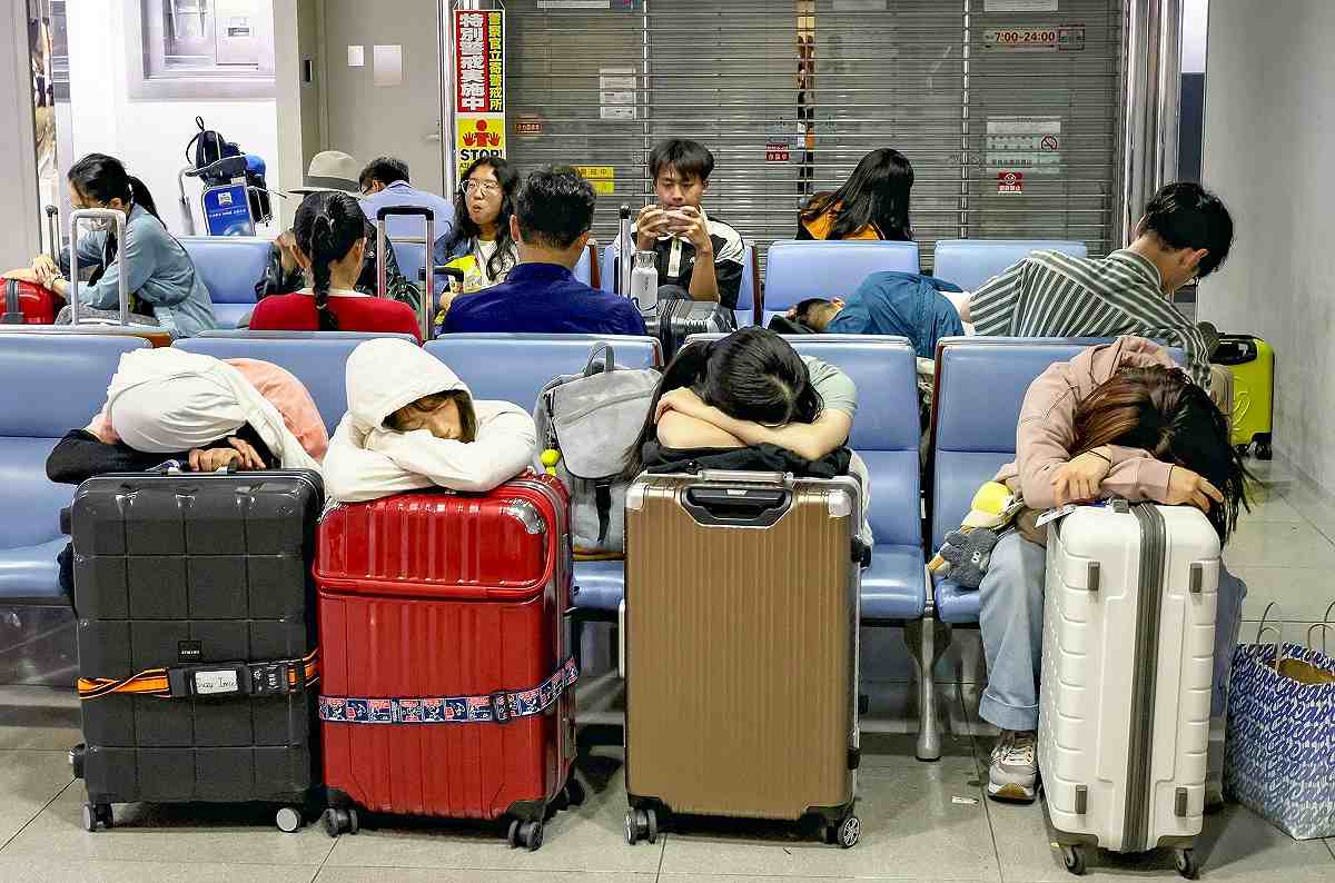
Exhausted travelers are seen at a domestic departures lobby of Kansai International Airport in Osaka Prefecture on Saturday as flights were canceled.
15:29 JST, September 3, 2024
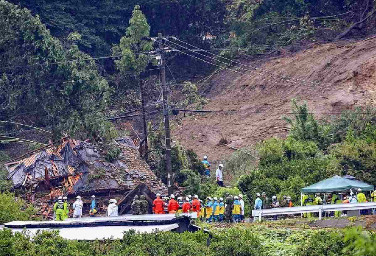
A house destroyed by a mudslide is seen in Gamagori, Aichi Prefecture, on Wednesday.
Typhoon Shanshan turned into a tropical cyclone on Sunday off the Pacific coast of the Tokai region and disappeared by early Monday, according to the Japan Meteorological Agency. Originating near the Mariana Islands in the Pacific Ocean on Aug. 22, the typhoon moved slowly, causing heavy rain in various parts of Japan that disrupted transportation and triggered mudslides.
Seven deaths had been confirmed, one person was missing and 129 people had been injured as of 6 p.m. Sunday, according to The Yomiuri Shimbun’s tally.
Also referred to as Typhoon No. 10, the storm moved in a complex pattern. After landing on Kagoshima Prefecture on Thursday, it moved slowly from Kyushu to Shikoku. It spurred heavy rain in Kyushu, and in locations not directly hit by the typhoon in the Kanto and Tokai regions.
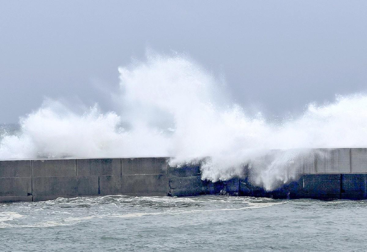
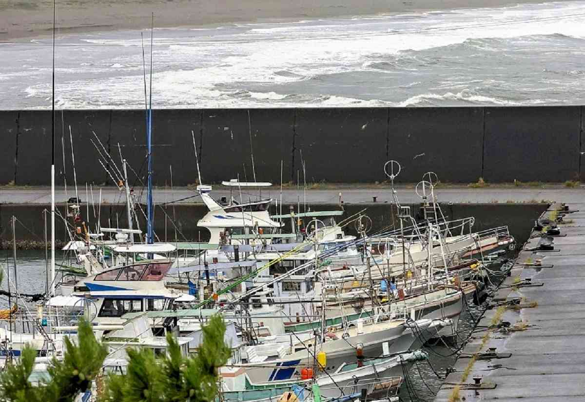
Left: High waves surge into a fishing port in Kochi on Thursday. Right: Fishing boats are moored in a fishing port in Kuroshio, Kochi Prefecture, in preparation for the approaching typhoon on Thursday.
Sea surface temperatures south of Japan, where the typhoon advanced, are said to have been as hot as those in the tropics this summer. As a result, a large amount of water vapor supplied by the ocean developed the typhoon to nearly the strongest level.
Precipitation from Aug. 27, when the typhoon approached Japan, through 11 a.m. on Sunday reached 942 millimeters in Izu, Shizuoka Prefecture, which is 2.3 times the normal amount of precipitation for the whole of August, according to the Japan Meteorological Agency. There were 911 millimeters of precipitation in Ebino, Miyazaki Prefecture, over the same period.
-
The Yomiuri Shimbun
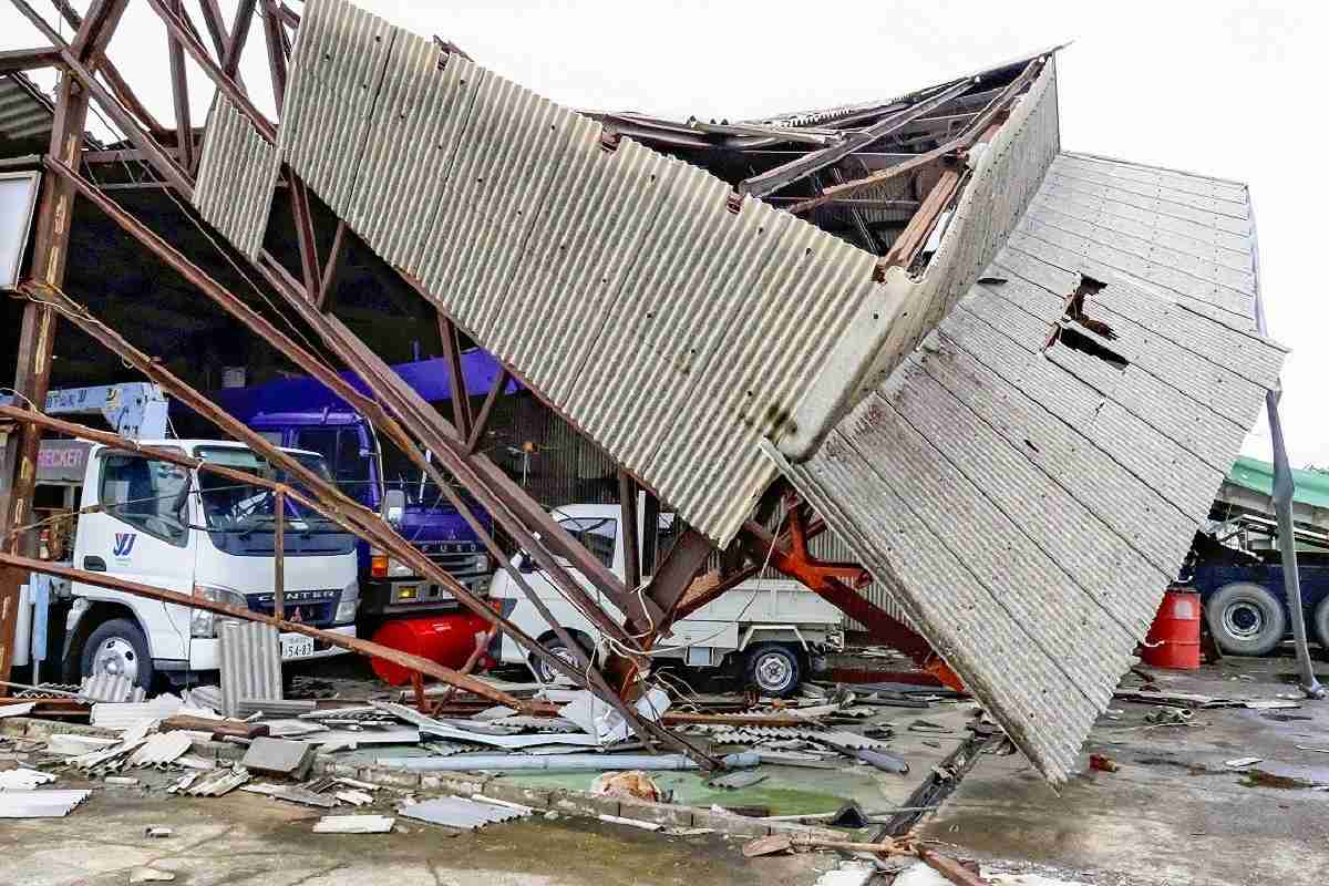
A building apparently damaged by wind gusts is seen in Miyazaki on Thursday. -
The Yomiuri Shimbun
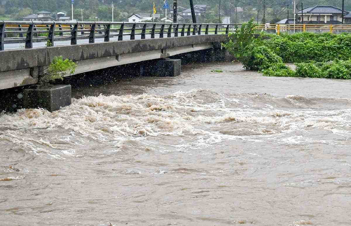
The Niho River in Yamaguchi is seen swollen by heavy rain on Friday. -
The Yomiuri Shimbun
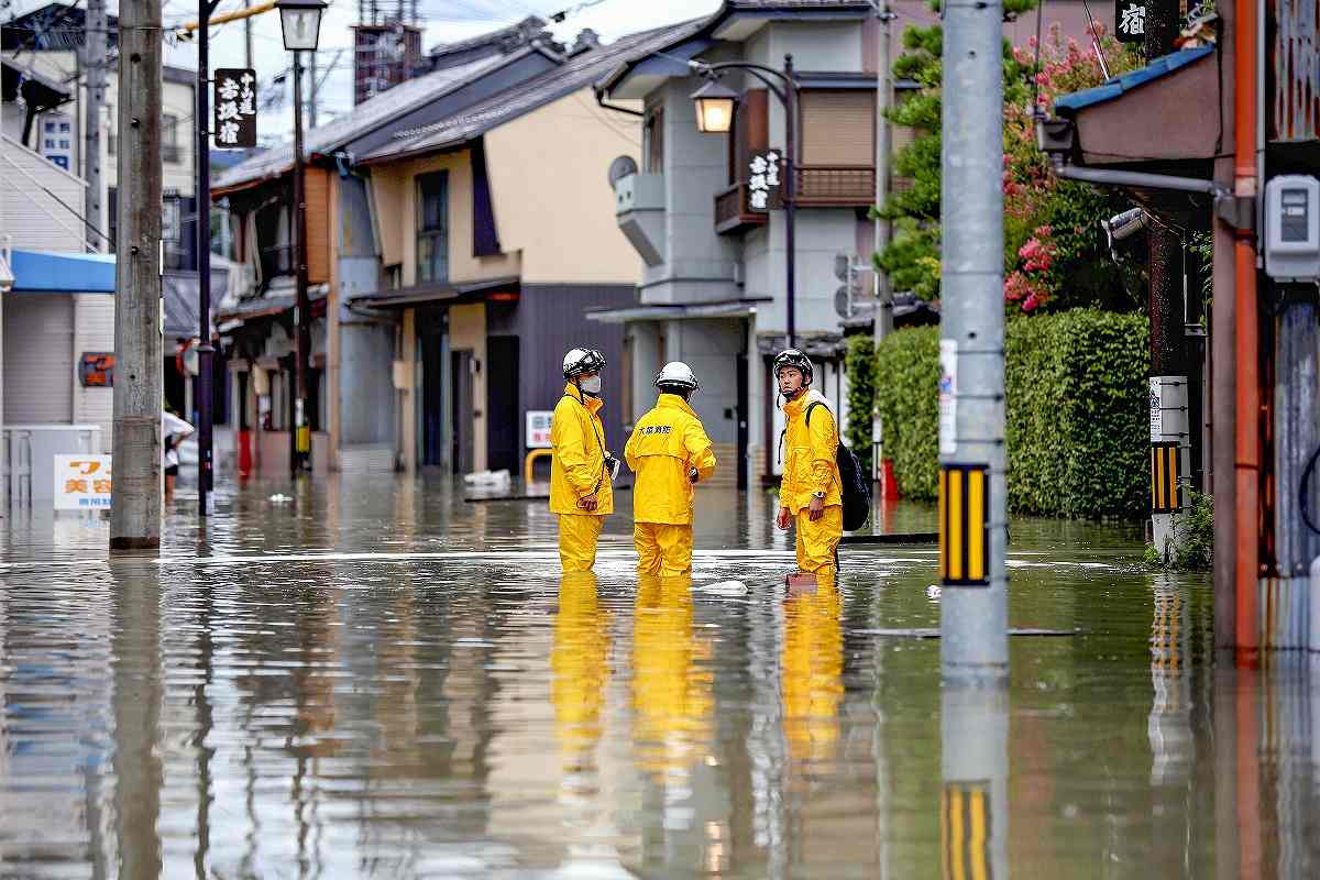
A residential area is seen flooded by heavy rain in Ogaki, Gifu Prefecture, on Saturday. -
The Yomiuri Shimbun
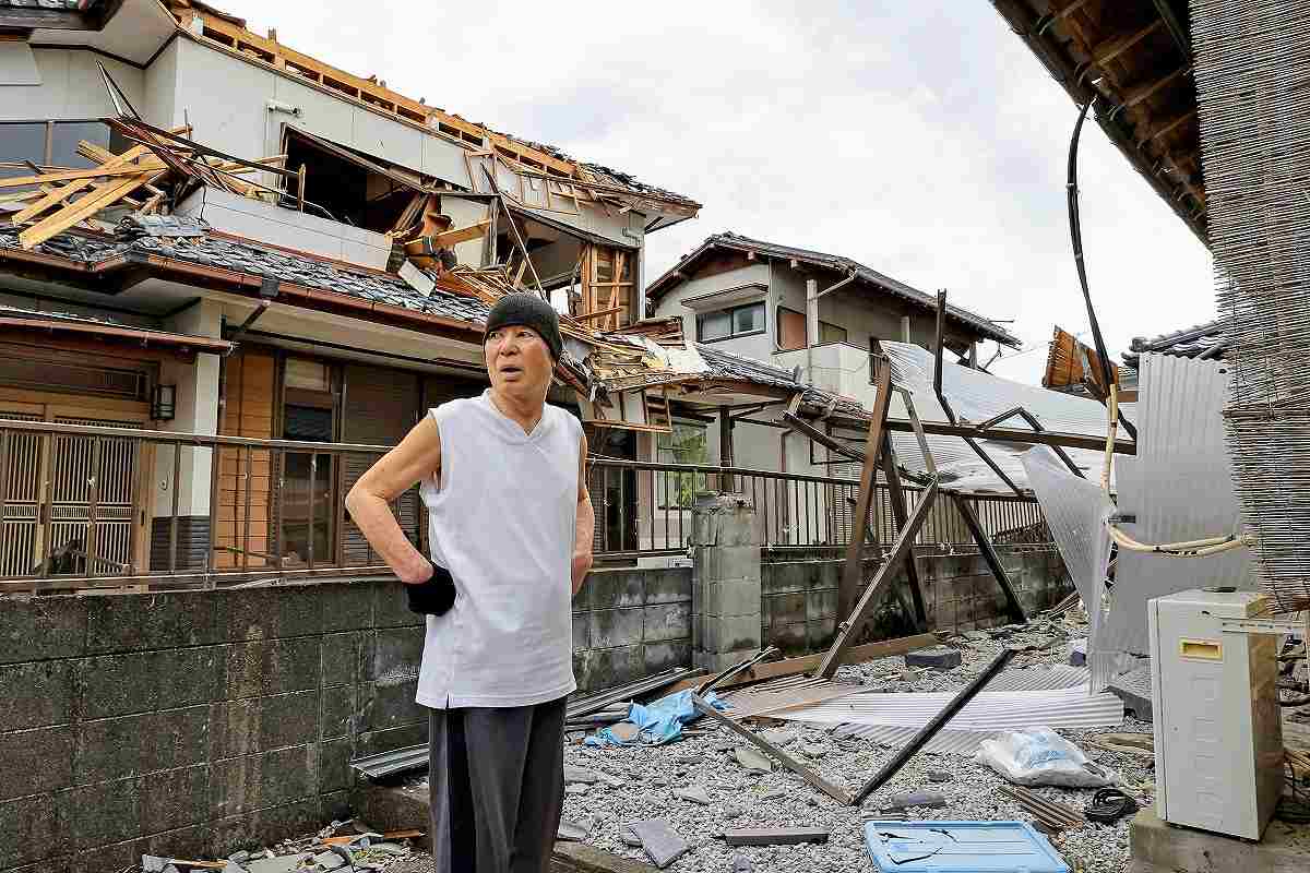
A resident stands in a residential area damaged by wind gusts in Miyazaki on Friday.
Related Tags


Most Read
Popular articles in the past 24 hours
-

BOJ Keeping Eye on Economy and Takaichi's ‘Proactive Fiscal Polic...
-
Tokyo Measles Patient Traveled to Fukuoka Aboard JAL Planes; Susp...
-

Party Representatives’ Questions in Diet: Takaichi Says Consumpti...
-

Govt to Set Working-Level Meeting Group for Refundable Tax Credit...
-

Milano Cortina 2026: News in Pictures / Feats of Japanese Athlete...
-

Pokémon Celebrates 30 Years with Japanese Pro Baseball Collab
-

Nikkei Crosses 59,000 for First Time on Software Rally; Gains Shr...
-

Death Penalty Sought for Murder of U.S. Man, Family in Saitama Pr...
Popular articles in the past week
-
Producer Behind Pop Group XG Arrested for Cocaine Possession
-

iPS Treatments Pass Key Milestone, but Broader Applications Far f...
-

Tokyo Skytree's Elevator Stops, Trapping 20 People; All Rescued (...
-

Milano Cortina 2026: Japanese Gold Medalist Figure Skater Miura S...
-

Nepal Bus Crash Kills 19 People, Injures 25 Including One Japanes...
-

Japan’s Major Real Estate Firms Expanding Overseas Businesses to ...
-

Baby Monkey Punch Captures Hearts at Chiba Pref. Zoo, on Social M...
-

Milano Cortina 2026: Japanese Figure Skater Kaori Sakamoto’...
Popular articles in the past month
-
Producer Behind Pop Group XG Arrested for Cocaine Possession
-

Japan PM Takaichi’s Cabinet Resigns en Masse
-

Japan Institute to Use Domestic Commercial Optical Lattice Clock ...
-

Man Infected with Measles Reportedly Dined at Restaurant in Tokyo...
-

Israeli Ambassador to Japan Speaks about Japan’s Role in the Reco...
-

Videos Plagiarized, Reposted with False Subtitles Claiming ‘Ryuky...
-

Man Infected with Measles May Have Come in Contact with Many Peop...
-

Prudential Life Insurance Plans to Fully Compensate for Damages C...
Top Articles in Society
-
Producer Behind Pop Group XG Arrested for Cocaine Possession
-
Man Infected with Measles Reportedly Dined at Restaurant in Tokyo Station
-
Man Infected with Measles May Have Come in Contact with Many People in Tokyo, Went to Store, Restaurant Around When Symptoms Emerged
-
Woman with Measles Visited Hospital in Tokyo Multiple Times Before Being Diagnosed with Disease
-
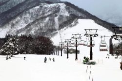
Australian Woman Dies After Mishap on Ski Lift in Nagano Prefecture
JN ACCESS RANKING
-
Producer Behind Pop Group XG Arrested for Cocaine Possession
-
Japan PM Takaichi’s Cabinet Resigns en Masse
-
Man Infected with Measles Reportedly Dined at Restaurant in Tokyo Station
-
Israeli Ambassador to Japan Speaks about Japan’s Role in the Reconstruction of Gaza
-
Videos Plagiarized, Reposted with False Subtitles Claiming ‘Ryukyu Belongs to China’; Anti-China False Information Also Posted in Japan