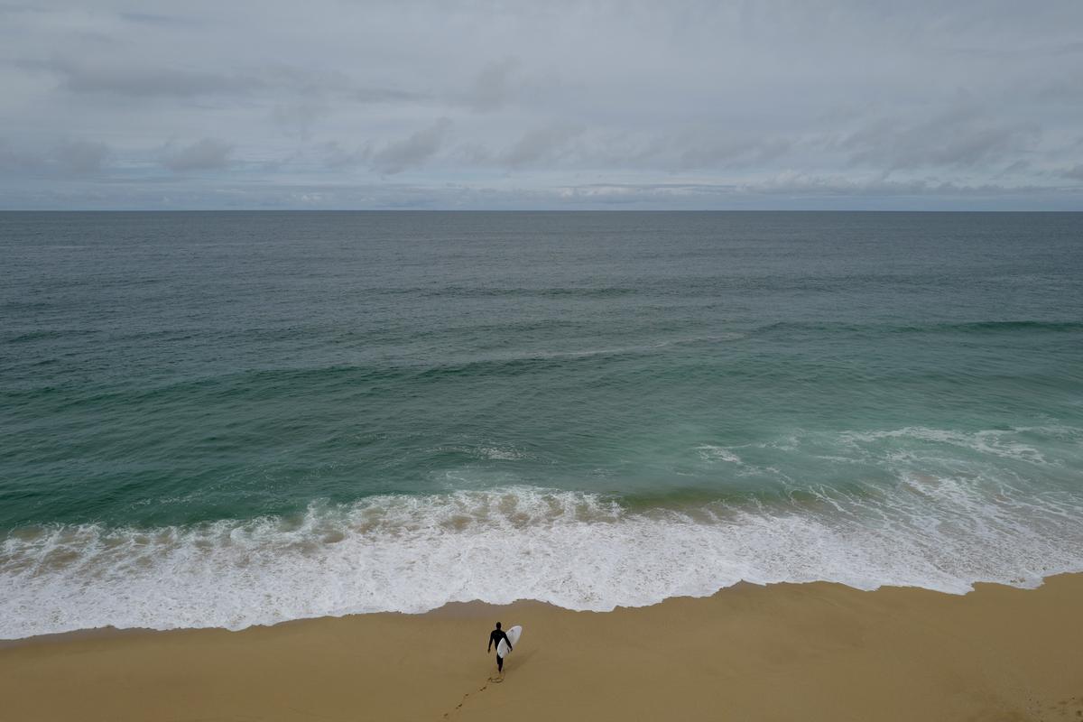
The beach in Montara, California, seen in 2019.
13:19 JST, February 10, 2026
For the second time in as many months, a wind burst occurred in a remote part of the western Pacific Ocean during January – and odds are rising that it will trigger a significant change in the planet’s weather patterns later this year.
These wind bursts – which are breaking records for their strength – are pushing some of the world’s warmest ocean water from the West Pacific south of Guam toward South America, a phenomenon that signal a shift toward a planet-warming El Niño.
This likely shift was confirmed by new climate outlook data released by the European Center for Medium-Range Weather Forecasts, which predicts El Niño will arrive by summer. While the pattern is marked by warmer-than-average ocean waters spanning the equatorial Pacific Ocean, its effects stretch far from this region.
Although these effects won’t be immediate, El Niño could influence severe weather and hurricane seasons in the United States later this year; alter rainfall patterns in South America, Africa and Asia; influence the likelihood of coral bleaching; and trigger changes in Arctic and Antarctic sea ice, as heat building near the equator eventually moves elsewhere – and maybe spells new global temperature records.
How warm the planet could get
The El Niño event that formed in 2023 and peaked around the start of 2024 significantly contributed to the planet’s warmest year on record in 2024.
Comparing global temperature anomalies in 2023 with those predicted through July can provide clues as to how warm the planet could get – and whether the planet may soon break the record set in 2024.
As of February, model forecasts suggest that global temperatures to start 2026 will be higher than in 2023. This means that the period from 2026 to 2028 may be on a course to set new worldwide temperature records.
“Heat comes out of the ocean during El Niño and contributes to global warming,” said Kevin Trenberth, a distinguished scholar at the National Center of Atmospheric Research.
That ocean heat is emanating from a place called the Western Pacific Warm Pool – which set records for warmth in 2025. In fact, last year was the ninth consecutive year during which global ocean heat content records were broken.
According to Trenberth, global temperatures peak about three months after El Niño does – which may make 2027 the year to watch for new global temperature records.
Defense Department meteorologist Eric Webb described this change in global temperatures during major El Niño events as an upward “stairstep.”
“Due to the increasing concentration of greenhouse gases, the climate system cannot effectively exhaust the heat released in a major El Niño event before the next El Niño comes along and pushes the baseline upward again,” he said.
What El Niño could bring to the U.S.
Warming equatorial waters in the Pacific gradually trigger changes in tropical rain and thunderstorm patterns, which have flow-on effects for the planet’s weather patterns, delivered through changes in jet streams. These patterns connected over long distances are called teleconnections – Mother Nature’s way of making a long-distance phone call.
“At this point with the ocean and atmosphere looking most likely to transition to El Niño, I’d lean towards a less active Atlantic [hurricane] season,” said meteorologist Andy Hazelton.
Webb agreed, saying that it could be a “generally less active season basin-wide than we have seen in some time,” but also said that it is still important to be prepared.
Although El Niño tends to reduce Atlantic hurricane activity, that effect could be suppressed if ocean temperatures in the Atlantic are well above average. Near-record-high ocean heat content in 2025 caused three hurricanes to catapult to Category 5 intensity.
El Niño can influence severe weather season in the United States, too. In an average year, about 1,200 twisters form across the country – particularly from March to June – but El Niño can lead to fewer spring tornadoes. That’s especially the case in pockets of the southern Plains and Mid-South. At the same time, El Niño can lead to increased tornado frequency in parts of the Deep South, related to changes in the jet stream.
Webb added that El Niño onset years also tend to be more active in June across the northern and central Plains.
However, because La Niña will probably be transitioning toward El Niño during spring, it’s unclear which of the two will have the most dominant influence on severe weather.
As far as temperatures go, the National Oceanic and Atmospheric Administration favors elevated odds for above-average temperatures through April across the Southwest, Southeast and Mid-Atlantic – as the influences of a waning La Niña and building El Niño compete.
El Niño and La Niña are the most significant drivers of year-to-year climate variability on the planet. But these two, opposite phases aren’t on and off switches. They’re more like light dimmers, gradually turning up or down in intensity, existing on a spectrum rather than flipping between extremes.
That can make it more challenging to communicate their potential impacts, especially when one phase is transitioning toward another – and El Niño and La Niña engage in a figurative climate tug-of-war.
And before we can measure the strength of an El Niño, one needs to first form. That’s where westerly wind bursts come in – usually the first clue that an El Niño is brewing.
What a westerly wind burst is
A westerly wind burst isn’t the frigid wind that’s been whistling through your door all winter – it’s actually a warm, tropical wind blowing near New Caledonia, the Solomon Islands and Papua New Guinea in the Pacific.
Typically, winds blow from east to west across the tropical Pacific Ocean, forming a predictable pattern called trade winds. These trade winds cause some of the planet’s warmest ocean water to pile up in the western Pacific, near Papua New Guinea and the Philippines. But a few times a year on average, winds weaken and reverse direction, blowing from west to east at about 15 mph for a few weeks – forming a westerly wind burst.
Winds from a westerly wind burst push warm water east from the Western Pacific Warm Pool, home to the planet’s warmest ocean waters. This happens as the phenomenon spurs slow-moving and large oceanic waves called Kelvin waves.
“Unlike the waves you see at the beach, Kelvin waves do not curl over and then crash. They are more like the waves in your bathtub, which slowly slosh around,” said Michelle L’Heureux of NOAA.
A westerly wind burst in December caused a Kelvin wave to form, with warm water now gliding a few hundred feet below the surface of the Pacific Ocean. The January wind burst will reinforce and strengthen the pattern that developed last month, probably forming another warmth-shifting Kelvin wave.
Kelvin waves take two to three months to cross the Pacific. Long-range forecast models predict this warmer ocean water will reach the eastern Pacific, near Peru and Ecuador in South America, during February and March – with weather impacts gradually building across the planet after that.


Most Read
Popular articles in the past 24 hours
-

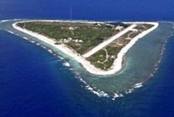
Seeking Nuclear Waste Site, Japan Eyes Remote Island of Minami-To...
-

Japan’s Govt Says No Immediate Impact on Oil Supply; No Releases ...
-
Japan Ministry Asks to Conduct Nuclear Waste Disposal-related Sur...
-
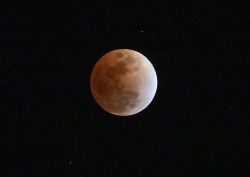
Total Lunar Eclipse Visible for Some in Japan, While Clouds Block...
-

WBC to Begin: All the Pieces are in Place for Japan’s Second Stra...
-

Tokyo High Court Upholds Unification Church Dissolution Order; Li...
-

Artisans from Disaster-Hit Areas Work Together to Keep Memories o...
-

Milano Cortina 2026: Ceremony for Winter Paralympic Torch Relay T...
Popular articles in the past week
-

Tokyo Spends Big on Children, Wins Over Parents
-

Japan’s Miura, Kihara Announce Withdrawal from Figure Skating Wor...
-

South Korea Tightens Rules on Foreigners Buying Homes in Seoul Me...
-

BOJ Keeping Eye on Economy and Takaichi's ‘Proactive Fiscal Polic...
-

Tokyo Measles Patient Traveled to Fukuoka Aboard JAL Planes; Susp...
-

Nidec Chairman Resigns Amid Accounting Scandal at Major Japanese ...
-
Strait of Hormuz Closure Shakes Markets; Prolonged Closure Could ...
-
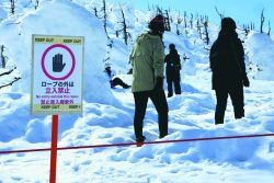
Tourists Ignore Safety Barriers Near Famous Zao ‘Snow Monsters’ i...
Popular articles in the past month
-

Producer Behind Pop Group XG Arrested for Cocaine Possession
-

Japan PM Takaichi’s Cabinet Resigns en Masse
-

Man Infected with Measles Reportedly Dined at Restaurant in Tokyo...
-

Israeli Ambassador to Japan Speaks about Japan’s Role in the Reco...
-

Videos Plagiarized, Reposted with False Subtitles Claiming ‘Ryuky...
-

Prudential Life Insurance Plans to Fully Compensate for Damages C...
-

Woman with Measles Visited Hospital in Tokyo Multiple Times Befor...
-

iPS Treatments Pass Key Milestone, but Broader Applications Far f...
Top Articles in News Services
-

Survey Shows False Election Info Perceived as True
-
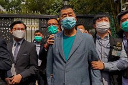
Hong Kong Ex-Publisher Jimmy Lai’s Sentence Raises International Outcry as China Defends It
-

Japan’s Nikkei Stock Average Falls as US-Iran Tensions Unsettle Investors (UPDATE 1)
-
Japan’s Nikkei Stock Average Touches 58,000 as Yen, Jgbs Rally on Election Fallout (UPDATE 1)
-
Japan’s Nikkei Stock Average Rises on Tech Rally and Takaichi’s Spending Hopes (UPDATE 1)
JN ACCESS RANKING
-
Producer Behind Pop Group XG Arrested for Cocaine Possession
-
Japan PM Takaichi’s Cabinet Resigns en Masse
-
Man Infected with Measles Reportedly Dined at Restaurant in Tokyo Station
-
Israeli Ambassador to Japan Speaks about Japan’s Role in the Reconstruction of Gaza
-
Videos Plagiarized, Reposted with False Subtitles Claiming ‘Ryukyu Belongs to China’; Anti-China False Information Also Posted in Japan