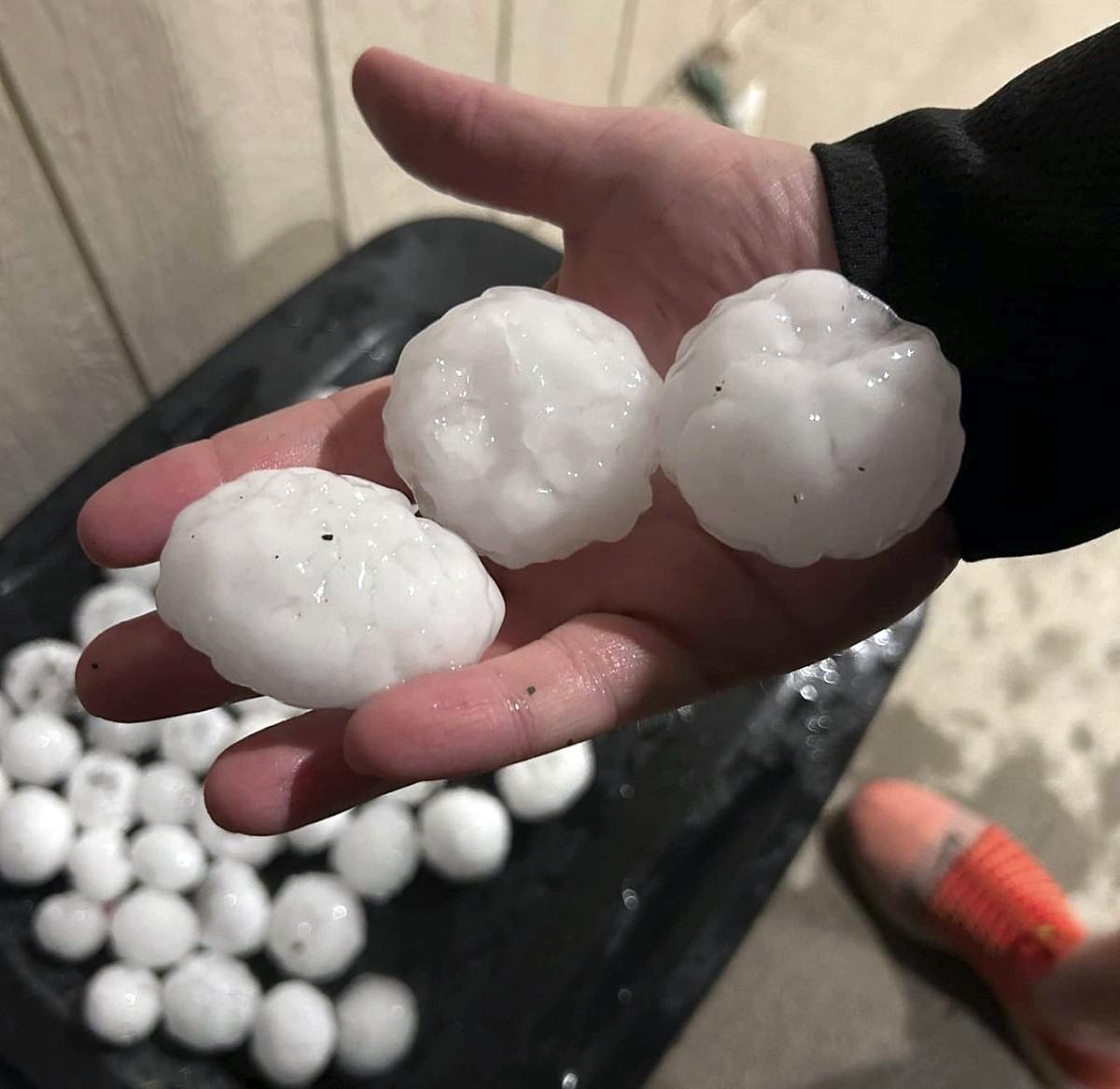
In this image provided by Jeremy Crabtree, large chunks of hail are shown, Wednesday night, March 13, 2024, in Shawnee, Kan.
15:30 JST, March 14, 2024
ST. LOUIS (AP) — Massive chunks of hail pelted parts of Kansas and Missouri on Wednesday night, bringing traffic to a standstill along Interstate 70 and unleashing a possible tornado, as meteorologists urged residents to stay indoors.
At least one unconfirmed tornado was reported Wednesday in Alta Vista, Kansas, according to media reports. The National Weather Service in Topeka said quarter-size hail and wind gusts up to 60 mph (96 kph) were expected across northern Kansas overnight until 6 a.m. on Thursday.
Descriptions of the hail ranged from the size of golf balls and apples, to softballs and baseballs.
Alex Sosnowski, senior meteorologist at AccuWeather, previously said the predicted hail was deemed “gorilla hail” because it had the potential to be so big.
“Gorilla hail” is a term coined by Reed Timmer, a storm chaser who calls himself an extreme meteorologist, Sosnowski said. In this case, the term might fit: Some hail from north-central Kansas into north-central Missouri could be as big as a baseball.
“When you get up to tennis ball, baseball-sized or God forbid softball-sized, that can do a tremendous amount of damage, and if you get hit in the head, that could be fatal,” Sosnowski said.
Traffic came to a standstill for a time on part of Interstate 70 because of the falling hail, the National Weather Service said on X. Images of large hail chunks and at least one cracked windshield were shown on KSHB-TV.
Late Wednesday, forecasters issued tornado warnings in the areas around Topeka and to the north, while severe thunderstorm warnings were issued northeast of Kansas City in Missouri.
“If you are in this warning, get away from windows and shelter inside now!!!” the National Weather Service posted on X, formerly known as Twitter. The weather service said the storm had previously produced “softball-sized hail,” or 3.5-inch (8.9-centimeter) chunks.
The weather service also issued a severe thunderstorm watch for parts of Illinois, Iowa, Missouri and Kansas through Thursday morning, after which forecasters said the storm will move to the east.
While the hail threat lessens Thursday, meteorologists said heavy rain and high winds were still possible from northeastern Texas through central Missouri.
The biggest threat on Friday is for torrential rain — perhaps up to 4 inches (10 centimeters) in some spots — in a line from central Louisiana up through central Arkansas, Sosnowski said.
Top Articles in News Services
-

Survey Shows False Election Info Perceived as True
-

Japan’s Nikkei Stock Average Falls as US-Iran Tensions Unsettle Investors (UPDATE 1)
-

Japan’s Nikkei Stock Average Touches 58,000 as Yen, Jgbs Rally on Election Fallout (UPDATE 1)
-

Japan’s Nikkei Stock Average Rises on Tech Rally and Takaichi’s Spending Hopes (UPDATE 1)
-

Japan to Ban Use of Power Banks on Airplanes
JN ACCESS RANKING
-

Producer Behind Pop Group XG Arrested for Cocaine Possession
-

Japan PM Takaichi’s Cabinet Resigns en Masse
-

Man Infected with Measles Reportedly Dined at Restaurant in Tokyo Station
-

Videos Plagiarized, Reposted with False Subtitles Claiming ‘Ryukyu Belongs to China’; Anti-China False Information Also Posted in Japan
-

iPS Treatments Pass Key Milestone, but Broader Applications Far from Guaranteed


