Iceland Evacuates Town and Raises Aviation Alert as Concerns Rise That a Volcano May Erupt
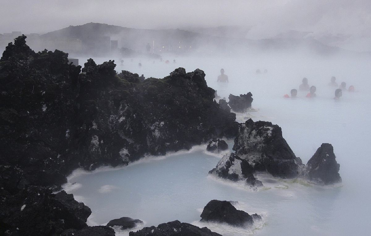
In this Feb. 21, 2006 file photo Tourists relax in the Blue Lagoon geothermal spa, Iceland on Feb. 21,2006.
14:22 JST, November 15, 2023
LONDON (AP) — Residents of a fishing town in southwestern Iceland left their homes Saturday after increasing concern about a potential volcanic eruption caused civil defense authorities to declare a state of emergency in the region.
Police decided to evacuate Grindavik after recent seismic activity in the area moved south toward the town and monitoring indicated that a corridor of magma, or semi-molten rock, now extends under the community, Iceland’s Meteorological Office said. The town of 3,400 is on the Reykjanes Peninsula, about 50 kilometers (31 miles) southwest of the capital, Reykjavik.
At this stage, it is not possible to determine exactly whether and where magma might reach the surface, the Meteorological Office said.
Authorities also raised their aviation alert to orange, indicating an increased risk of a volcanic eruption. Volcanic eruptions pose a serious hazard to aviation because they can spew highly abrasive ash high into the atmosphere, where it can cause jet engines to fail, damage flight control systems and reduce visibility.
A major eruption in Iceland in 2010 caused widespread disruption to air travel between Europe and North America, costing airlines an estimated $3 billion as they canceled more than 100,000 flights.
The evacuation comes after the region was shaken by hundreds of small earthquakes every day for more than two weeks as scientists monitor a buildup of magma some 5 kilometers (3.1 miles) underground.
Concern about a possible eruption increased in the early hours of Thursday when a magnitude 4.8 earthquake hit the area, forcing the internationally known Blue Lagoon geothermal resort to close temporarily.
The seismic activity started in an area north of Grindavik where there is a network of 2,000-year-old craters, geology professor Pall Einarrson, told Iceland’s RUV. The magma corridor is about 10 kilometers (6.2 miles) long and spreading, he said.
The biggest earthquakes originated there, under this old series of craters, but since then it (the magma corridor) has been getting longer, went under the urban area in Grindavík and is heading even further and towards the sea, he said.


Popular Articles
Popular articles in the past 24 hours
-

Diplomacy with Central Asia: Utilize Long-Established Relationshi...
-
Poll Finds High Approval Rating for PM Takaichi’s Economic Measur...
-

Japan Actor Ryoko Hirosue Given Summary Indictment over Car Accid...
-

Japanese Actors Haru, Mahiro Takasugi Announce Marriage
-

Japan Shares Rise as Bond Yields Retreat; Tech Jitters Weigh on N...
-

9 Japanese Police Officers Suspected of Online Casino Gambling
-

Hepburn Romaji Deemed Standard for Japanese Words, Names; Change ...
-
Hakone Ekiden Banners Hung at Tokyo's JR Shinagawa Station Ahead ...
Popular articles in the past week
-
Israeli Tourists Refused Accommodation at Hotel in Japan’s Nagano...
-
U.S. Senate Resolution Backs Japan, Condemns China's Pressure
-

Sharp Decline in Number of Chinese Tourists But Overall Number of...
-

Japan Set to Participate in EU's R&D Framework, Aims to Boost Coo...
-
China Attacks Japan at U.N. Security Council Meetings; Representa...
-
Japan Backs Public-Private Cooperation on Economic Security; Nati...
-
As Chinese Tourists Shun Japan, Hotels and Stores Suffer
-

Bus Bound for Hokkaido's New Chitose Airport Catches Fire Wednesd...
Popular articles in the past month
-

Tokyo Economic Security Forum to Hold Inaugural Meeting Amid Tens...
-
Keidanren Chairman Yoshinobu Tsutsui Visits Kashiwazaki-Kariwa Nu...
-
Imports of Rare Earths from China Facing Delays, May Be Caused by...
-

University of Tokyo Professor Discusses Japanese Economic Securit...
-
Japan Pulls out of Vietnam Nuclear Project, Complicating Hanoi's ...
-

Govt Aims to Expand NISA Program Lineup, Abolish Age Restriction
-
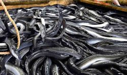
Blanket Eel Trade Restrictions Rejected
-
Key Japan Labor Group to Seek Pay Scale Hike
"News Services" POPULAR ARTICLE
-

American Playwright Jeremy O. Harris Arrested in Japan on Alleged Drug Smuggling
-
Japan’s Nikkei Stock Average as JGB Yields, Yen Rise on Rate-Hike Bets
-
Japan’s Nikkei Stock Average Licks Wounds after Selloff Sparked by BOJ Hike Bets (UPDATE 1)
-
Japan’s Nikkei Stock Average Buoyed by Stable Yen; SoftBank’s Slide Caps Gains (UPDATE 1)
-
Japanese Bond Yields Zoom, Stocks Slide as Rate Hike Looms
JN ACCESS RANKING
-
Tokyo Economic Security Forum to Hold Inaugural Meeting Amid Tense Global Environment
-
Keidanren Chairman Yoshinobu Tsutsui Visits Kashiwazaki-Kariwa Nuclear Power Plant; Inspects New Emergency Safety System
-
Imports of Rare Earths from China Facing Delays, May Be Caused by Deterioration of Japan-China Relations
-
University of Tokyo Professor Discusses Japanese Economic Security in Interview Ahead of Forum
-
Japan Pulls out of Vietnam Nuclear Project, Complicating Hanoi’s Power Plans