Devastation of Massive Fire in Japan’s Oita City Seen in Drone Photo, 187 Structures Declared Burned Down
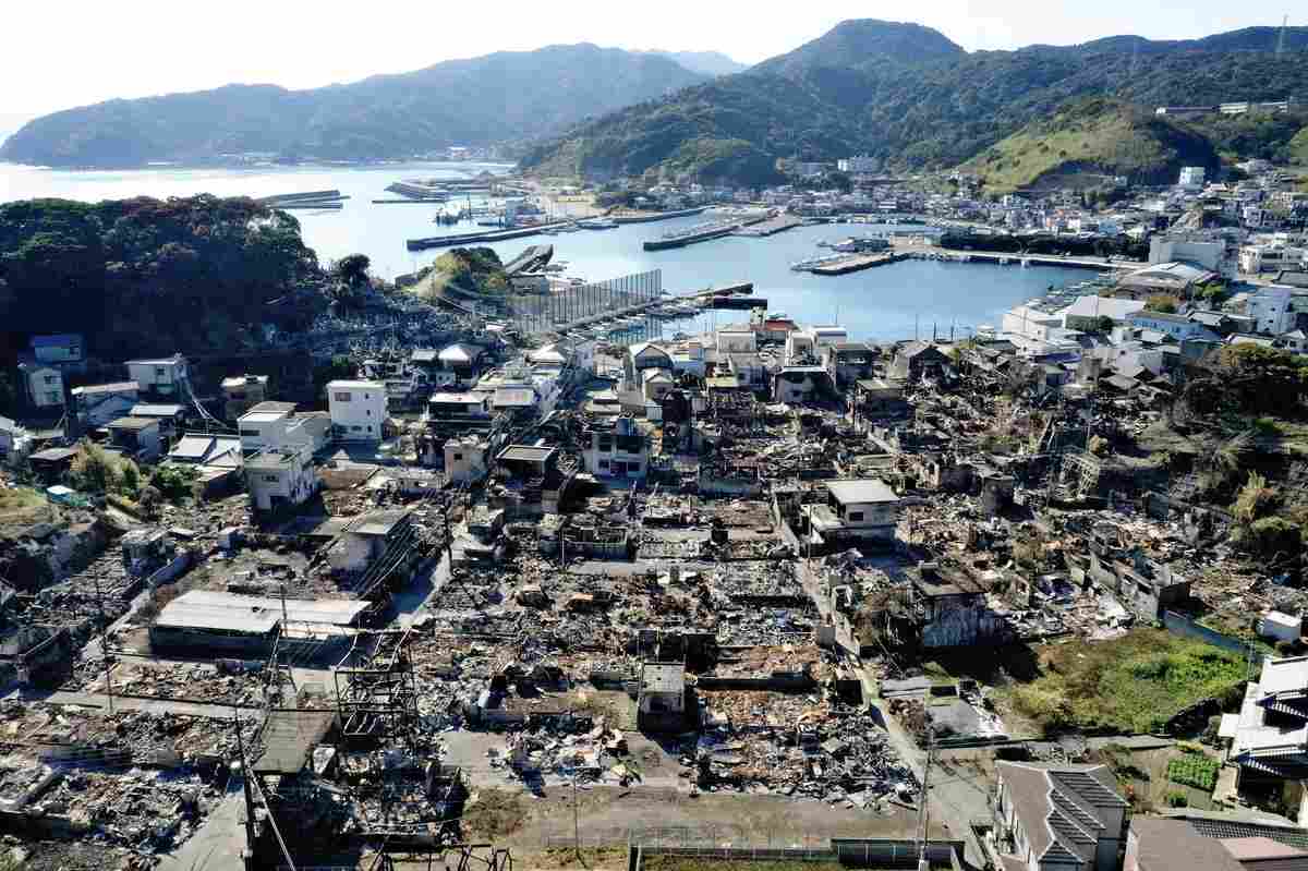
An aerial photo taken by a drone shows a scorched area in the Saganoseki district in Oita on Saturday.
18:02 JST, December 7, 2025
OITA — A vast expanse of scorched land in a densely populated residential area of the Saganoseki district in Oita was captured in an aerial photo The Yomiuri Shimbun took on Saturday via a drone.
The area was devastated by a massive fire that started on the evening of Nov. 18.
The collapsed roofs and shattered windows of buildings whose structures still remained can be seen in the photo.
According to the Oita municipal government in a preliminary tally, the fire burned down 187 structures, with the burned area totaling about 48,900 square meters across the Saganoseki Peninsula residential area and part of the forested hills nearby.
The blaze was declared extinguished on Thursday, including the uninhabited Tsutashima Island, where the fire had spread.
Drone flights had been prohibited around the area because of helicopter firefighting operations, but the ban was lifted after the fire was declared extinguished.
Related Tags


Most Read
Popular articles in the past 24 hours
-
Japanese Shipping Giants Halt Strait of Hormuz Transit as Iran Co...
-

U.S. Launches Attacks on Iran: Avoid Escalation of Conflict by An...
-

Sawtooth Roof Factory Stands as Monument to Ashikaga Textile Hist...
-

Parents of Japanese Teen Shot in U.S. Strive for Gun Control
-

Disinformation Spreads About Team Mirai, Ballot Readers; Online P...
-
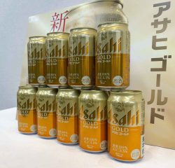
Asahi Breweries to Stage Comeback with New Product in April; Comp...
-

Bank of Japan Deputy Governor Says Rate Hikes Likely to Continue
-

Japanese Government Bonds Rally, Yields Tumble as Iran Strikes Sp...
Popular articles in the past week
-

Nepal Bus Crash Kills 19 People, Injures 25 Including One Japanes...
-

Milano Cortina 2026: Japanese Gold Medalist Figure Skater Miura S...
-
Tokyo Spends Big on Children, Wins Over Parents
-

McDonald's Japan Raises Prices; Big Mac to Cost ¥500, Double Chee...
-

Japan’s Miura, Kihara Announce Withdrawal from Figure Skating Wor...
-

Exhibition Featuring Yoshiharu Tsuge’s Manga World Underway in Ch...
-

Yokohama to Test Out Renewable-Powered Offshore Floating Data Cen...
-

BOJ Keeping Eye on Economy and Takaichi's ‘Proactive Fiscal Polic...
Popular articles in the past month
-
Producer Behind Pop Group XG Arrested for Cocaine Possession
-

Japan PM Takaichi’s Cabinet Resigns en Masse
-

Man Infected with Measles Reportedly Dined at Restaurant in Tokyo...
-

Israeli Ambassador to Japan Speaks about Japan’s Role in the Reco...
-

Videos Plagiarized, Reposted with False Subtitles Claiming ‘Ryuky...
-

Man Infected with Measles May Have Come in Contact with Many Peop...
-

Prudential Life Insurance Plans to Fully Compensate for Damages C...
-
Woman with Measles Visited Hospital in Tokyo Multiple Times Befor...
Top Articles in Society
-
Producer Behind Pop Group XG Arrested for Cocaine Possession
-
Man Infected with Measles Reportedly Dined at Restaurant in Tokyo Station
-
Man Infected with Measles May Have Come in Contact with Many People in Tokyo, Went to Store, Restaurant Around When Symptoms Emerged
-
Woman with Measles Visited Hospital in Tokyo Multiple Times Before Being Diagnosed with Disease
-

Bus Carrying 40 Passengers Catches Fire on Chuo Expressway; All Evacuate Safely
JN ACCESS RANKING
-
Producer Behind Pop Group XG Arrested for Cocaine Possession
-
Japan PM Takaichi’s Cabinet Resigns en Masse
-
Man Infected with Measles Reportedly Dined at Restaurant in Tokyo Station
-
Israeli Ambassador to Japan Speaks about Japan’s Role in the Reconstruction of Gaza
-
Videos Plagiarized, Reposted with False Subtitles Claiming ‘Ryukyu Belongs to China’; Anti-China False Information Also Posted in Japan