Drones, Smartphones to Be Used to Assess Flood Damage; Cabinet Office Approves Tech to Speed up Disaster Certificate Issuance
13:09 JST, July 7, 2024
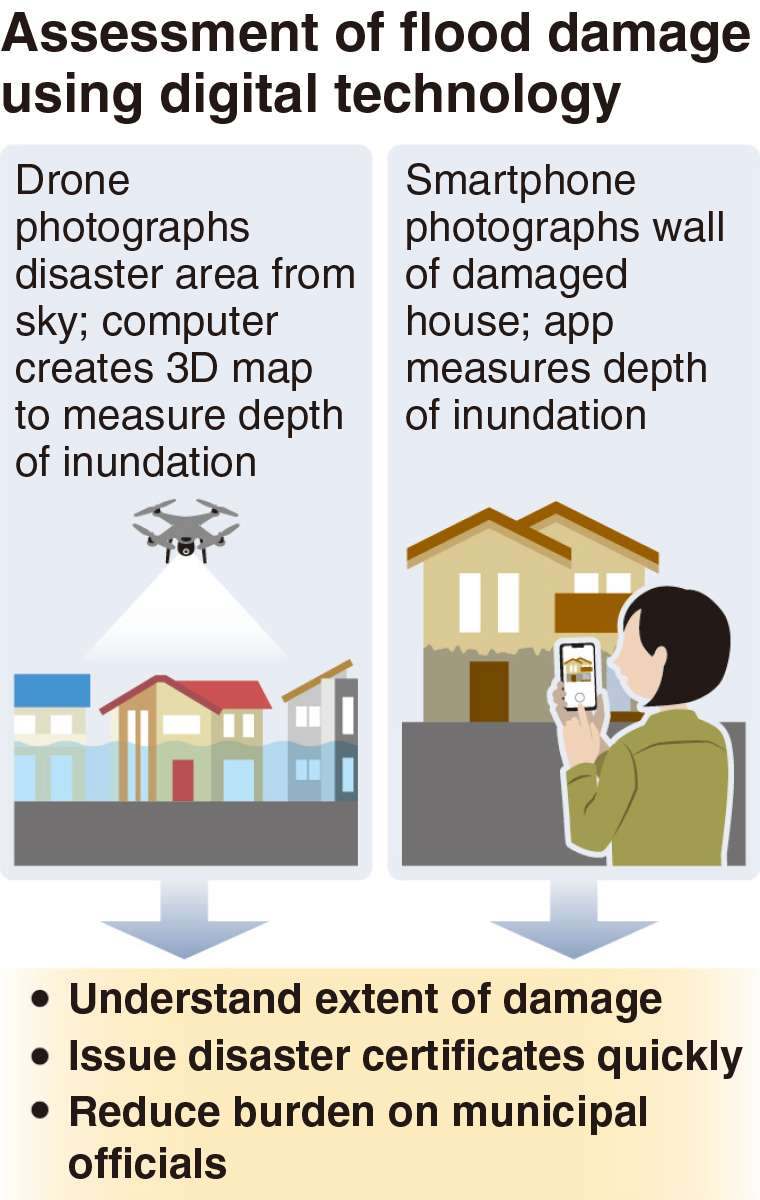
The use of drones and smartphones will be allowed in assessing the extent of damage caused to houses inundated when rainwater exceeds the capacity of drainage facilities and overflows on the ground.
The use of such digital technology became available on May 31, when the Cabinet Office revised its operational guidelines for how municipalities are to certify disaster damage, aiming to speed up the issuance of disaster certificates so that victims can rebuild their lives smoothly.
Camera-equipped drones can photograph a disaster area from the sky so a 3D map of the terrain and buildings can be created with a computer, while a smartphone app can be used to analyze photographs of the walls of a damaged house to measure the depth of flooding and determine the extent of damage.
Previously, municipal officials would visit a disaster site and inspect the damage to the walls and floors before issuing a disaster certificate, which is required for the victims to receive public assistance. A lack of manpower has delayed the inspections, resulting in certificates taking a long time to be issued. The use of drones and smartphones is expected to solve this problem.
Between October and February, tests of the technology were conducted in Ibaraki and Akita prefectures, both of which had suffered flooding earlier last year. The depth of inundation calculated by the technology was not significantly different from the actual depth, and the Cabinet Office deemed it practical and decided to bring it into general use. The office will offer training sessions to municipalities in hopes of encouraging more places to adopt it.


Most Read
Popular articles in the past 24 hours
-

Japan Govt to Tighten Requirements to Receive Permanent Residency...
-

‘King Kazu’ Discusses His Connection to Fukushima
-
JR Tokai Breaks Ground on Yamanashi Maglev Station; Will Be Part ...
-
Medical Care at Home and Disasters: Ensure Systems to Provide Con...
-
Metal Pipe That Protruded 13 Meters Above Ground in Osaka Sinks B...
-

White House Takes First Step toward Permanent Fix for Illegal Tar...
-
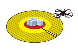
Japan to Extend Drone No-fly Zones Near Key Facilities to 1 km
-

The Japan News / Weekly Edition (3/13-3/19)
Popular articles in the past week
-

Japan Figure Skating Legend Yuzuru Hanyu Is Proud Disaster Surviv...
-

Nippon Life Insurance's U.S. Arm Sues OpenAI Over Legal Assistanc...
-
Govt to Utilize ODA for Ensuring Economic Security; Securing Ener...
-
Massive Sewer Pipe Found Jutting Out of Highway in Osaka
-

Beckoning Cats Get Makeover to Fit Modern Lifestyles with Sleek D...
-
Japan Govt Survey Finds Just 10% of Workers Want Working Hours to...
-
Japan's 2nd Round of U.S. Investments May Be Worth Over $100 Bill...
-

Imperial Family Watches World Baseball Classic Game Against Austr...
Popular articles in the past month
-

Producer Behind Pop Group XG Arrested for Cocaine Possession
-

Japan PM Takaichi’s Cabinet Resigns en Masse
-

Man Infected with Measles Reportedly Dined at Restaurant in Tokyo...
-

Videos Plagiarized, Reposted with False Subtitles Claiming ‘Ryuky...
-
Japan Figure Skating Legend Yuzuru Hanyu Is Proud Disaster Surviv...
-

iPS Treatments Pass Key Milestone, but Broader Applications Far f...
-

Sanae Takaichi Elected Prime Minister of Japan; Keeps All Cabinet...
-
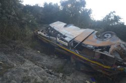
Nepal Bus Crash Kills 19 People, Injures 25 Including One Japanes...
Top Articles in Science & Nature
-
iPS Treatments Pass Key Milestone, but Broader Applications Far from Guaranteed
-

Record 700 Startups to Gather at SusHi Tech Tokyo in April; Event Will Center on Themes Like Artificial Intelligence and Robotics
-
iPS Cell Products for Parkinson’s, Heart Disease OK’d for Commercialization by Japan Health Ministry Panel
-

Japan to Ban Use of Power Banks on Airplanes
-
Japan Govt Aims for 10-Fold Increase in Computing Power of Supercomputers for AI Use at Universities, Research Institutions
JN ACCESS RANKING
-
Producer Behind Pop Group XG Arrested for Cocaine Possession
-
Japan PM Takaichi’s Cabinet Resigns en Masse
-
Man Infected with Measles Reportedly Dined at Restaurant in Tokyo Station
-
Videos Plagiarized, Reposted with False Subtitles Claiming ‘Ryukyu Belongs to China’; Anti-China False Information Also Posted in Japan
-
Japan Figure Skating Legend Yuzuru Hanyu Is Proud Disaster Survivor and Gold Medalist, Vows to Continue Support Efforts