Crustal Deformations Moved Wajima 2 Meters Southwest After Quake; Authorities to Resurvey Control Points on Noto Peninsula
Source: Geospatial Information Authority of Japan
17:28 JST, January 11, 2024
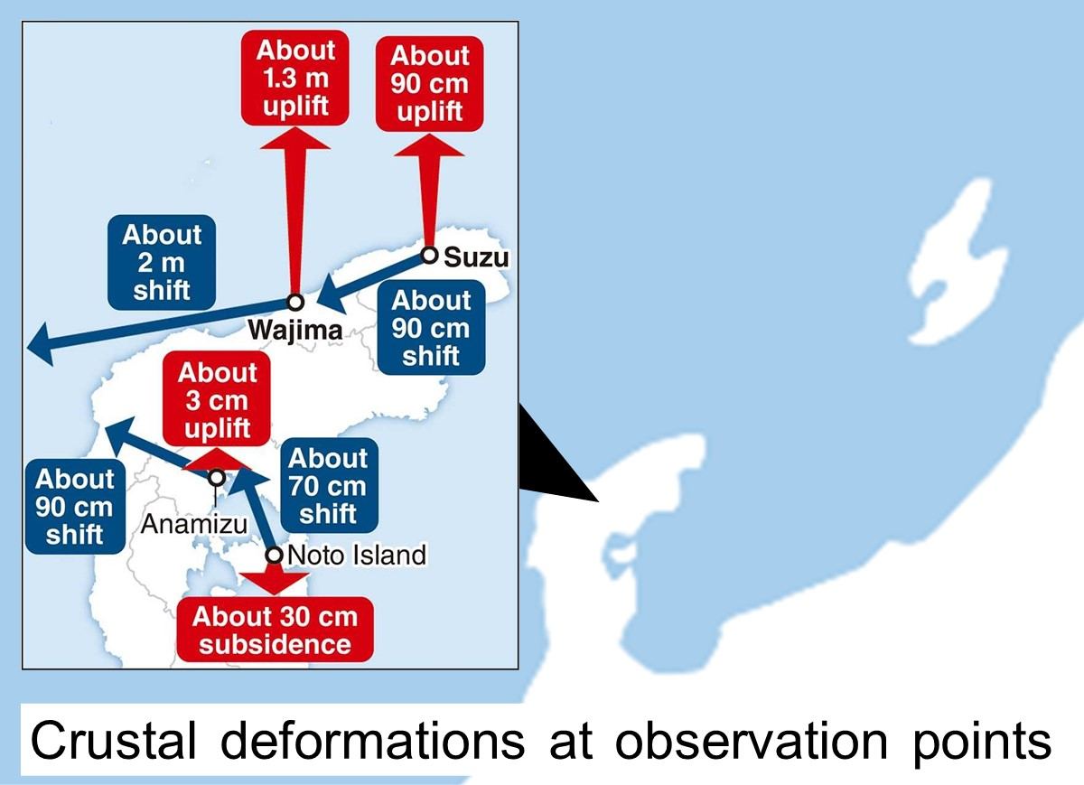
The city of Wajima, Ishikawa Prefecture, shifted a maximum of two meters southwest due to crustal deformations caused by the massive earthquake on New Year’s Day, according to analysis by the Geospatial Information Authority of Japan.
The authority also confirmed shifts of about 90 centimeters in both the city of Suzu and the town of Anamizu.
Many control points, which are used as the basis for creating maps, on the Noto Peninsula are believed to have been affected by crustal deformations caused by the Jan. 1 earthquake. The authority therefore plans to resurvey control points on the peninsula.
Officials analyzed location data from both pre- and post-quake observations, using the global positioning system among other methods.
They were initially unable to obtain certain data due to the deteriorated telecommunications environment, but managed to add missing data by Sunday and recalculated.
The largest crustal deformation was observed at a location near the coast in the eastern part of Wajima. The data from the location initially was not delivered to the authority, but the later additional data also showed a 1.3-meter uplift at the same location.
When the authority released its analysis on Jan. 2, an about 1.2-meter westward movement at a different location near central Wajima city was thought to be the maximum.
The latest analysis also confirmed the following crustal deformations:
*Suzu: About 90-centimeter shift to southwest, about 90-centimeter uplift
*Anamizu: About 90-centimeter shift to northwest, about 3-centimeter uplift
*Noto Island: About 70-centimeter shift to north, about 30-centimeter subsidence
Given the large scale of crustal deformations, the authority plans to resurvey control points in the Noto Peninsula.
A maximum shift of more than five meters was observed after the 2011 Great East Japan Earthquake. This prompted the authority to resurvey the so-called triangulation points, which represent the basis for longitude and latitude, at about 1,800 control points in the area.


Most Read
Popular articles in the past 24 hours
-

Voters Using AI to Choose Candidates in Japan's Upcoming General ...
-

Japan's Snow-Clad Beauty: Camellia Flowers Seen in Winter Bloom a...
-

Monkey Strikes Junior High School Girl from Behind in Japan's Yam...
-

Genichiro Inokuma's Mural in Ueno Station That Gave Hope in Postw...
-

Senior Japanese Citizens Return to University to Gain Knowledge, ...
-

Foreign and Security Policy: Political Parties Must Discuss How T...
-
Heavy Snow Linked to 30 Deaths across Japan since Late Jan.; JMA ...
-

Tokyo Police Arrest Head of Resignation Assistance Firm
Popular articles in the past week
-

Japan Institute to Use Domestic Commercial Optical Lattice Clock ...
-
Australian Woman Dies After Mishap on Ski Lift in Nagano Prefectu...
-
Foreign Snowboarder in Serious Condition After Hanging in Midair ...
-

Chinese Embassy in Japan Reiterates Call for Chinese People to Re...
-

Narita Airport, Startup in Japan Demonstrate Machine to Compress ...
-

Toyota Motor Group Firm to Sell Clean Energy Greenhouses for Stra...
-

Sakie Yokota, Last Surviving Parent of a North Korea Abductee, Ur...
-

Beer Yeast Helps Save Labor, Water Use in Growing Rice; Govt Hope...
Popular articles in the past month
-

Univ. in Japan, Tokyo-Based Startup to Develop Satellite for Disa...
-
JAL, ANA Cancel Flights During 3-day Holiday Weekend due to Blizz...
-

China Confirmed to Be Operating Drilling Vessel Near Japan-China ...
-

China Eyes Rare Earth Foothold in Malaysia to Maintain Dominance,...
-
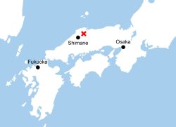
M6.2 Earthquake Hits Japan's Tottori, Shimane Prefectures; No Tsu...
-
Japan Institute to Use Domestic Commercial Optical Lattice Clock ...
-

Japan, Qatar Ministers Agree on Need for Stable Energy Supplies; ...
-

Japan, Italy to Boost LNG Cooperation; Aimed at Diversifying Japa...
Top Articles in Society
-
JAL, ANA Cancel Flights During 3-day Holiday Weekend due to Blizzard
-
Record-Breaking Snow Cripples Public Transport in Hokkaido; 7,000 People Stay Overnight at New Chitose Airport
-
Australian Woman Dies After Mishap on Ski Lift in Nagano Prefecture
-
Foreign Snowboarder in Serious Condition After Hanging in Midair from Chairlift in Nagano Prefecture
-

Train Services in Tokyo Resume Following Power Outage That Suspended Yamanote, Keihin-Tohoku Lines (Update 4)
JN ACCESS RANKING
-
Univ. in Japan, Tokyo-Based Startup to Develop Satellite for Disaster Prevention Measures, Bears
-
JAL, ANA Cancel Flights During 3-day Holiday Weekend due to Blizzard
-
China Confirmed to Be Operating Drilling Vessel Near Japan-China Median Line
-
China Eyes Rare Earth Foothold in Malaysia to Maintain Dominance, Counter Japan, U.S.
-
Japan Institute to Use Domestic Commercial Optical Lattice Clock to Set Japan Standard Time