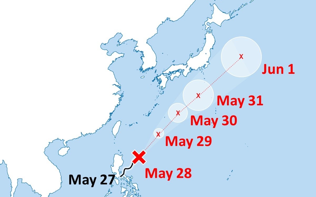
Typhoon Ewiniar Expected to Approach Minami-Daito Island May 29 Evening; Wind Speed at 35 Meters Per Second
13:04 JST, May 29, 2024
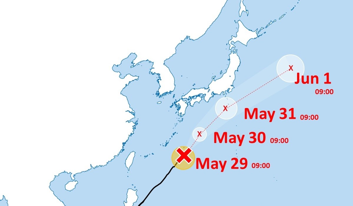
The strong Typhoon Ewiniar is expected to make its closest approach to Minami-Daito Island, Okinawa Prefecture, on Wednesday evening and Izu islands on Friday. The Japan Meteorological Agency has been raising the alarm over storms and high waves.
As of 9:00 a.m. Wednesday, the typhoon had moved northeast at a speed of 15 kph from the southwest of Minami-Daito Island, according to the agency. It has a central atmospheric pressure of 985 hPa and a maximum wind speed of 35 meters per second near its center.
It is expected to develop into an extratropical cyclone over the sea east of Japan by Saturday.
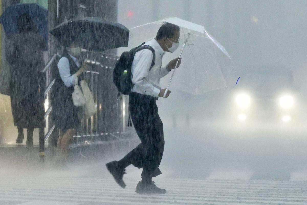
Record-Breaking Heavy Rain Hits Shikoku, Kyushu Regions; 89 Locations Marked Largest Rainfall in May
Related Tags
Top Articles in Society
-
Earthquake Hits Japan’s Tohoku Region; 3-meter Tsunami Warning Issued (Update 1)
-

Police Find Child’s Shoe During Search for Missing Boy in Nantan, Kyoto Prefecture
-

Body Found in Nantan, Kyoto Prefecture, During Search for 11-Year-Old Boy in Area (Update 1)
-

Cherry Blossoms, Rapeseed Flowers Perform Colorful ‘Duet’ in Niigata
-

Two Women in Osaka Found Lying on Floor Bleeding, Later Pronounced Dead
JN ACCESS RANKING
-

Earthquake Hits Japan’s Tohoku Region; 3-meter Tsunami Warning Issued (Update 1)
-

Police Find Child’s Shoe During Search for Missing Boy in Nantan, Kyoto Prefecture
-

Body Found in Nantan, Kyoto Prefecture, During Search for 11-Year-Old Boy in Area (Update 1)
-

Cherry Blossoms, Rapeseed Flowers Perform Colorful ‘Duet’ in Niigata
-

Trump Extends the Ceasefire with Iran but Keeps the Blockade
Most read in the last 24 hours
-

Trump Extends the Ceasefire with Iran but Keeps the Blockade
-

China, South Korea Object to Japanese PM Takaichi's Ritual Offeri...
-

Trump Opposes United–American Merger, Signals Support for Spirit
-

Florida Launches Criminal Probe into OpenAI and ChatGPT over Dead...
-

Trump Picks a University of Minnesota Professor to Lead His Econo...
Most read in the last 7 days
-

Earthquake Hits Japan's Tohoku Region; 3-meter Tsunami Warning Is...
-

Trump Extends the Ceasefire with Iran but Keeps the Blockade
-

Olympic Gold Medal-Winning Figure Skaters Riku-Ryu Announce Retir...
-

China, South Korea Object to Japanese PM Takaichi's Ritual Offeri...
-

Japan to Ban Use of Portable Chargers on Airplanes from April 24,...
Most read in the last 30 days
-

Earthquake Hits Japan's Tohoku Region; 3-meter Tsunami Warning Is...
-

Police Find Child's Shoe During Search for Missing Boy in Nantan,...
-

Body Found in Nantan, Kyoto Prefecture, During Search for 11-Year...
-

Cherry Blossoms, Rapeseed Flowers Perform Colorful ‘Duet’ in Niig...
-

Trump Extends the Ceasefire with Iran but Keeps the Blockade
