Firefighters Make Progress against Fast-Moving Blaze Along Highway North of Los Angeles

This image provided by USDA Forest Service shows a 375 acre fire east of I-5 at Smokey Bear Road near Templin, Calif.
10:32 JST, August 15, 2025
GORMAN, Calif. (AP) — Firefighters with air support scrambled to control a wind-driven wildfire that erupted Thursday morning in hills along Interstate 5 in northwestern Los Angeles County, officials said.
The King Fire, which broke out around 1 a.m., charred nearly a square mile (2.5 square kilometers) of tinder-dry brush in a lightly populated area about 60 miles (100 kilometers) north of downtown LA.
An RV park was ordered to shelter in place and residents of remote homes were under evacuation warnings. The blaze was 20% contained, according to the Los Angeles County Fire Department.
The California Highway Patrol closed some highway lanes as crews battled flames that raced along hillsides before dawn. Off- and on-ramps were closed near Smokey Bear Road, along with several surrounding roads just north of Pyramid Lake in a mountainous area known for hiking and boating.
The blaze is burning a few miles north of the Canyon Fire, which prompted evacuations, destroyed seven structures and injured three firefighters after breaking out Aug. 7. It was fully contained Thursday morning after charring more than 8 square miles (22 square kilometers) of LA and Ventura counties.
Firefighters were also rushing to contain a blaze in northern Los Angeles County that had ballooned to more than 200 acres (81 hectares) in less than two hours Thursday afternoon, according to the Los Angeles County Fire Department.
Some residents in the small community of Acton were ordered to evacuate at the same time officials warned the blaze was a threat to the Angeles National Forest, less than a year after the Los Angeles area wildfires tore through the forest. The fire department said the Hawk Fire was uncontained.
The Gifford Fire, California’s largest blaze so far this year, has scorched nearly 207 square miles (536 square kilometers) of Santa Barbara and San Luis Obispo counties since erupting on Aug. 1. It was 41% contained on Thursday.
Wildfire risk is elevated because Southern California has seen very little rain, drying out vegetation and making it “ripe to burn,” the National Weather Service for Los Angeles warned in a statement last week.


Most Read
Popular articles in the past 24 hours
-

‘Dry Bonsai’ Gives New Life to Withered Trees, Allows Free Artist...
-

Japanese Students Use Traditional Pickle to Create Novel Wagashi ...
-

McDonald's Japan Raises Prices; Big Mac to Cost ¥500, Double Chee...
-
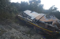
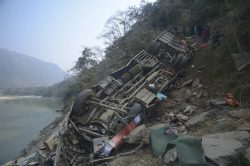
Nepal Bus Crash Kills 19 People, Injures 25 Including One Japanes...
-

Japan’s Nikkei Stock Average Rises as AI-Related Stocks Shine; Co...
-

Joruri Bunraku Narrative Performed in Honor of Donald Keene by La...
-

Astellas Collaborates with Vir to Develop Its Experimental Prosta...
-

Aggression against Ukraine: Malignant Precedent Must Not Be Set t...
Popular articles in the past week
-
Producer Behind Pop Group XG Arrested for Cocaine Possession
-

Japan PM Takaichi’s Cabinet Resigns en Masse
-

Sanae Takaichi Elected Prime Minister of Japan; Keeps All Cabinet...
-

Japan's Govt to Submit Road Map for Growth Strategy in March, PM ...
-

Bus Carrying 40 Passengers Catches Fire on Chuo Expressway; All E...
-
U.S. Firm to Build Training Hub in Fukushima N-plant for Debris R...
-

Japan, U.S. Name 3 Inaugural Investment Projects; Reached Agreeme...
-

Riku-Ryu Pair Wins Gold Medal: Their Strong Bond Leads to Major C...
Popular articles in the past month
-
Producer Behind Pop Group XG Arrested for Cocaine Possession
-
Japan PM Takaichi’s Cabinet Resigns en Masse
-

Japan Institute to Use Domestic Commercial Optical Lattice Clock ...
-

Man Infected with Measles Reportedly Dined at Restaurant in Tokyo...
-

Israeli Ambassador to Japan Speaks about Japan’s Role in the Reco...
-

Videos Plagiarized, Reposted with False Subtitles Claiming ‘Ryuky...
-

Man Infected with Measles May Have Come in Contact with Many Peop...
-

Prudential Life Insurance Plans to Fully Compensate for Damages C...
Top Articles in News Services
-
Survey Shows False Election Info Perceived as True
-
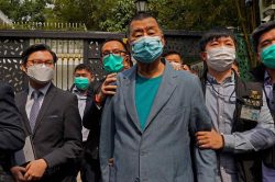
Hong Kong Ex-Publisher Jimmy Lai’s Sentence Raises International Outcry as China Defends It
-
Japan’s Nikkei Stock Average Touches 58,000 as Yen, Jgbs Rally on Election Fallout (UPDATE 1)
-
Japan’s Nikkei Stock Average Falls as US-Iran Tensions Unsettle Investors (UPDATE 1)
-

Trump Names Former Federal Reserve Governor Warsh as the Next Fed Chair, Replacing Powell
JN ACCESS RANKING
-
Producer Behind Pop Group XG Arrested for Cocaine Possession
-
Japan PM Takaichi’s Cabinet Resigns en Masse
-
Japan Institute to Use Domestic Commercial Optical Lattice Clock to Set Japan Standard Time
-
Man Infected with Measles Reportedly Dined at Restaurant in Tokyo Station
-
Israeli Ambassador to Japan Speaks about Japan’s Role in the Reconstruction of Gaza