Firefighters Make Progress against Fast-Moving Blaze Along Highway North of Los Angeles

This image provided by USDA Forest Service shows a 375 acre fire east of I-5 at Smokey Bear Road near Templin, Calif.
10:32 JST, August 15, 2025
GORMAN, Calif. (AP) — Firefighters with air support scrambled to control a wind-driven wildfire that erupted Thursday morning in hills along Interstate 5 in northwestern Los Angeles County, officials said.
The King Fire, which broke out around 1 a.m., charred nearly a square mile (2.5 square kilometers) of tinder-dry brush in a lightly populated area about 60 miles (100 kilometers) north of downtown LA.
An RV park was ordered to shelter in place and residents of remote homes were under evacuation warnings. The blaze was 20% contained, according to the Los Angeles County Fire Department.
The California Highway Patrol closed some highway lanes as crews battled flames that raced along hillsides before dawn. Off- and on-ramps were closed near Smokey Bear Road, along with several surrounding roads just north of Pyramid Lake in a mountainous area known for hiking and boating.
The blaze is burning a few miles north of the Canyon Fire, which prompted evacuations, destroyed seven structures and injured three firefighters after breaking out Aug. 7. It was fully contained Thursday morning after charring more than 8 square miles (22 square kilometers) of LA and Ventura counties.
Firefighters were also rushing to contain a blaze in northern Los Angeles County that had ballooned to more than 200 acres (81 hectares) in less than two hours Thursday afternoon, according to the Los Angeles County Fire Department.
Some residents in the small community of Acton were ordered to evacuate at the same time officials warned the blaze was a threat to the Angeles National Forest, less than a year after the Los Angeles area wildfires tore through the forest. The fire department said the Hawk Fire was uncontained.
The Gifford Fire, California’s largest blaze so far this year, has scorched nearly 207 square miles (536 square kilometers) of Santa Barbara and San Luis Obispo counties since erupting on Aug. 1. It was 41% contained on Thursday.
Wildfire risk is elevated because Southern California has seen very little rain, drying out vegetation and making it “ripe to burn,” the National Weather Service for Los Angeles warned in a statement last week.


Most Read
Popular articles in the past 24 hours
-
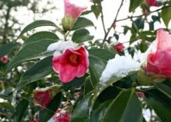
Japan's Snow-Clad Beauty: Camellia Flowers Seen in Winter Bloom a...
-

Monkey Strikes Junior High School Girl from Behind in Japan's Yam...
-
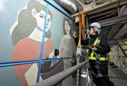
Genichiro Inokuma's Mural in Ueno Station That Gave Hope in Postw...
-

Foreign and Security Policy: Political Parties Must Discuss How T...
-

Senior Japanese Citizens Return to University to Gain Knowledge, ...
-
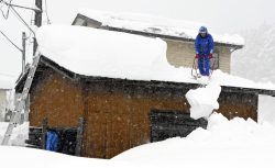
Heavy Snow Linked to 30 Deaths across Japan since Late Jan.; JMA ...
-

Tokyo Police Arrest Head of Resignation Assistance Firm
-

Japan’s Nikkei Stock Average Jumps near 4%, Closes at Record High...
Popular articles in the past week
-

Japan Institute to Use Domestic Commercial Optical Lattice Clock ...
-
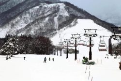
Australian Woman Dies After Mishap on Ski Lift in Nagano Prefectu...
-
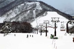
Foreign Snowboarder in Serious Condition After Hanging in Midair ...
-

Chinese Embassy in Japan Reiterates Call for Chinese People to Re...
-

Narita Airport, Startup in Japan Demonstrate Machine to Compress ...
-

Toyota Motor Group Firm to Sell Clean Energy Greenhouses for Stra...
-

Sakie Yokota, Last Surviving Parent of a North Korea Abductee, Ur...
-
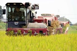
Beer Yeast Helps Save Labor, Water Use in Growing Rice; Govt Hope...
Popular articles in the past month
-

Univ. in Japan, Tokyo-Based Startup to Develop Satellite for Disa...
-
JAL, ANA Cancel Flights During 3-day Holiday Weekend due to Blizz...
-
China Confirmed to Be Operating Drilling Vessel Near Japan-China ...
-
China Eyes Rare Earth Foothold in Malaysia to Maintain Dominance,...
-
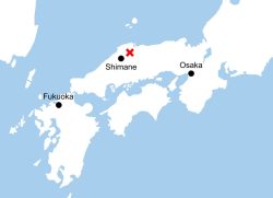
M6.2 Earthquake Hits Japan's Tottori, Shimane Prefectures; No Tsu...
-
Japan Institute to Use Domestic Commercial Optical Lattice Clock ...
-

Japan, Qatar Ministers Agree on Need for Stable Energy Supplies; ...
-

Japan, Italy to Boost LNG Cooperation; Aimed at Diversifying Japa...
Top Articles in News Services
-
Arctic Sees Unprecedented Heat as Climate Impacts Cascade
-

Prudential Life Expected to Face Inspection over Fraud
-

South Korea Prosecutor Seeks Death Penalty for Ex-President Yoon over Martial Law (Update)
-

Trump Names Former Federal Reserve Governor Warsh as the Next Fed Chair, Replacing Powell
-

Japan’s Nagasaki, Okinawa Make N.Y. Times’ 52 Places to Go in 2026
JN ACCESS RANKING
-
Univ. in Japan, Tokyo-Based Startup to Develop Satellite for Disaster Prevention Measures, Bears
-
JAL, ANA Cancel Flights During 3-day Holiday Weekend due to Blizzard
-
China Confirmed to Be Operating Drilling Vessel Near Japan-China Median Line
-
China Eyes Rare Earth Foothold in Malaysia to Maintain Dominance, Counter Japan, U.S.
-
Japan Institute to Use Domestic Commercial Optical Lattice Clock to Set Japan Standard Time