
The Japan Meteorological Agency
17:51 JST, August 11, 2023
Tropical Storm Lan was upgraded from “strong” to “very strong” in the early hours of Friday. By 10 a.m., it was located approximately 80 kilometers southeast of Hahajima Island, moving slowly northward. The central atmospheric pressure is 940 hectopascals, with a maximum wind speed near the center of 45 meters per second and a maximum gust speed of 65 meters per second. Speeds of 25 meters per second or more are being experienced within a radius of 130 kilometers from the center, causing violent winds. The tropical storm is expected to come closest to the Ogasawara Islands in the evening. The Japan Meteorological Agency has called for refraining from non-essential outings and exercising utmost caution against strong winds, landslides, high waves and high tides. Vigilance is also required for flooding in low-lying areas and rising river levels.
The tropical storm is moving northward with its stormy area expanding. After approaching the Ogasawara Islands, it is projected to move northwestward, and by Tuesday and Wednesday, it will maintain its strong intensity as it approaches Honshu. As a result, Eastern and Western Japan will experience turbulent weather starting around Monday. Concerns are raised about the impact on transport, such as the potential suspension or delay of Tokaido Shinkansen bullet trains between Sunday and Wednesday.
Top Articles in Society
-
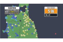
Earthquake Hits Japan’s Tohoku Region; 3-meter Tsunami Warning Issued (Update 1)
-

Police Find Child’s Shoe During Search for Missing Boy in Nantan, Kyoto Prefecture
-

Body Found in Nantan, Kyoto Prefecture, During Search for 11-Year-Old Boy in Area (Update 1)
-

Cherry Blossoms, Rapeseed Flowers Perform Colorful ‘Duet’ in Niigata
-

Japan to Ban Use of Portable Chargers on Airplanes from April 24, Number of Regular Chargers To Be Limited to 2
JN ACCESS RANKING
-

Earthquake Hits Japan’s Tohoku Region; 3-meter Tsunami Warning Issued (Update 1)
-

Police Find Child’s Shoe During Search for Missing Boy in Nantan, Kyoto Prefecture
-

Body Found in Nantan, Kyoto Prefecture, During Search for 11-Year-Old Boy in Area (Update 1)
-

Cherry Blossoms, Rapeseed Flowers Perform Colorful ‘Duet’ in Niigata
-

China, South Korea Object to Japanese PM Takaichi’s Ritual Offering to Yasukuni Shrine
Most read in the last 24 hours
-

India’s Arms Indigenization Quest for Self-Reliance / Big Firms, ...
-

Japan Moves Closer to Blocking Illegal Online Casinos as Governme...
-

Shifts Startup Focus to Nurturing Global Winners
-

Princess Aiko Enjoys Imperial Court Music, Dance; Production, Cos...
-

Bibimbap with Spring Vegetables and Asari Clam Miso a Rich Taste ...
Most read in the last 7 days
-

Earthquake Hits Japan's Tohoku Region; 3-meter Tsunami Warning Is...
-

China, South Korea Object to Japanese PM Takaichi's Ritual Offeri...
-

Trump Extends the Ceasefire with Iran but Keeps the Blockade
-

India's Arms Indigenization Quest for Self-Reliance / New Delhi S...
-

¥1,000 Coins to Be Issued to Mark Anniversary of Beginning of Jap...
Most read in the last 30 days
-

Earthquake Hits Japan's Tohoku Region; 3-meter Tsunami Warning Is...
-

Police Find Child's Shoe During Search for Missing Boy in Nantan,...
-

Body Found in Nantan, Kyoto Prefecture, During Search for 11-Year...
-

Cherry Blossoms, Rapeseed Flowers Perform Colorful ‘Duet’ in Niig...
-

China, South Korea Object to Japanese PM Takaichi's Ritual Offeri...


