To use this site, please disable the ad blocking feature and reload the page.
This website uses cookies to collect information about your visit for purposes such as showing you personalized ads and content, and analyzing our website traffic. By clicking “Accept all,” you will allow the use of these cookies.
Users accessing this site from EEA countries and UK are unable to view this site without your consent. We apologize for any inconvenience caused.
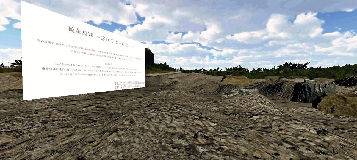
A screen grab taken from a virtual reality map produced by a group of grandchildren of former Iwoto islanders
By Hitoshi Kawabata / Yomiuri Shimbun Staff Writer
2:00 JST, March 25, 2023
Grandchildren of former residents of Iwoto Island in Ogasawara, Tokyo, have created a virtual reality map of part of the island to convey its history to younger generations.
Fierce battles took place on the island during the Pacific War.
The map features pre-war and modern-day photo panels, allowing viewers to compare the different eras. Residents who were forced to evacuate to the mainland during the war have not been allowed to return to the Pacific Ocean island — located about 1,250 kilometers from central Tokyo — due primarily to volcanic activity.
The map project was spearheaded by a group mainly comprising third-generation children of former residents.
The island was first settled in 1889 with the aim of extracting sulfur. Later, sugarcane was cultivated. In 1944, about 1,000 residents were ordered to evacuate the island. In February and March1945, Japan and the United States fought on the island, resulting in the deaths of more than 20,000 Japanese soldiers and about 7,000 U.S. servicemen. Most of the about 100 residents who did not evacuate and who served as civilian personnel to support Japan’s military also died.
Iwoto was returned to Japan by the United States in 1968, but the Japanese government declared it was difficult people to return due to volcanic activity, among other reasons. Nonetheless, delegations of former residents are allowed to make exceptional trips to the island to visit family graves.
Against this background, the group, which formed in 2018, began digitizing old photos depicting island life. Images for the VR map were taken at Iwo ga Oka hill — near the former center of the island — with a 360-degree camera in August 2022 when a delegation organized by the Kanto district council of Junior Chamber International Japan visited. Photos were also taken on the former site of a prewar elementary school, among other facilities.
The old photos seen in the map belonged to the evacuees who fled the island in summer 1944. The Kanto council, which organizes visits to Iwoto Island, recognized the historical value of the photos and encouraged the group to incorporate them into the map.
The map — which can be downloaded and viewed on smartphones and computers in an app called “Cluster” — can been found by inputting the Japanese kanji characters for “Iwoto.”
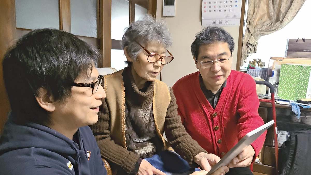
The Yomiuri Shimbun Former Iwoto Island resident, Tokiko Okuyama, center, talks with Ryoma Nishimura, left, in Matsudo City, Chiba Prefecture, on March 5.
Looking back
The map has helped some former islanders reconnect with the past. Tokiko Okuyama, 89, of Matsudo City, Chiba Prefecture, lost her two brothers who had remained behind on the island. “I can’t forget my brothers, Okuyama said. “I want to go back to the island to visit their graves.”
Iwo ga Oka hill stirs strong memories for Okuyama, as she and her brothers used to eat potatoes there, cooking them with hot steam that emanated from the ground.
The group’s chairman, Ryoma Nishimura, said, “I was seriously concerned that our ancestors who pioneered life on the island … would be forgotten if we did nothing.”
Nishimura’s grandparents lived on the island. The 41 year-old who also serves as a member of the VR-map production team, remembers the words of his grandmother, Yasuko Kikuchi, who said, “Don’t forget our island.” Kikuchi died at 92 in 2015.
In February, Nishimura visited Iwoto for the first time in seven years. While there, he visited the former site of a recently rediscovered factory that made sugarcane shochu spirit. “People lived on and developed the island before the war came along,” Nishimura said. “We’re keen to pass down the island’s history to future generations.”
The group aims to increase the scope of the VR map in the future.