To use this site, please disable the ad blocking feature and reload the page.
This website uses cookies to collect information about your visit for purposes such as showing you personalized ads and content, and analyzing our website traffic. By clicking “Accept all,” you will allow the use of these cookies.
Users accessing this site from EEA countries and UK are unable to view this site without your consent. We apologize for any inconvenience caused.
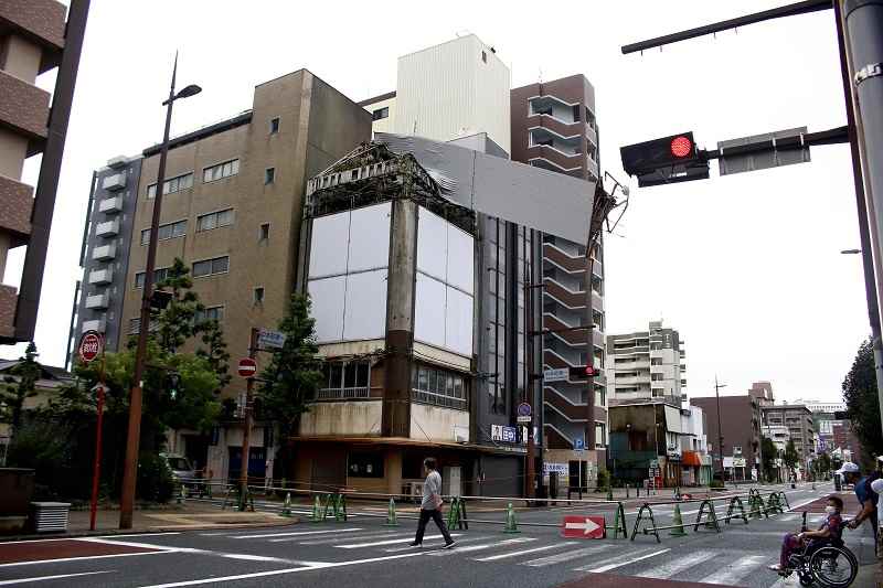
The Yomiuri Shimbun A billboard knocked down apparently by wind from Typhoon No. 14 is seen at the top of a building in Kitakyushu on Monday.
The Yomiuri Shimbun
17:31 JST, September 19, 2022
Extremely powerful Typhoon No. 14 moved toward the northeast around Shimane Prefecture on Monday after making landfall in the vicinity of Kagoshima City on Sunday night.
The Japan Meteorological Agency forecast that linear precipitation bands will occur in the Kansai region on Tuesday morning and in the Tokai region from late Monday through Tuesday morning, warning of strong winds, high tides and the risk of landslides and flooding rivers.
The typhoon is forecast to move northeastward over Honshu on Tuesday. It will weaken into an extratropical cyclone by Tuesday night off the east coast of Japan, however, wide swaths of the nation will likely feel the effects of the storm.
Rain from the typhoon is expected to be heavy and intense through Tuesday. The forecast calls for upwards of 400 millimeters of precipitation in the 24 hours to noon Tuesday in some locations in the Tokai region, 300 millimeters each in the Kansai and Kanto-Koshin regions, 250 millimeters in Shikoku, 150 millimeters in the Chugoku, Hokuriku and Tohoku regions as well as Hokkaido and 100 millimeters in northern Kyushu.