To use this site, please disable the ad blocking feature and reload the page.
This website uses cookies to collect information about your visit for purposes such as showing you personalized ads and content, and analyzing our website traffic. By clicking “Accept all,” you will allow the use of these cookies.
Users accessing this site from EEA countries and UK are unable to view this site without your consent. We apologize for any inconvenience caused.
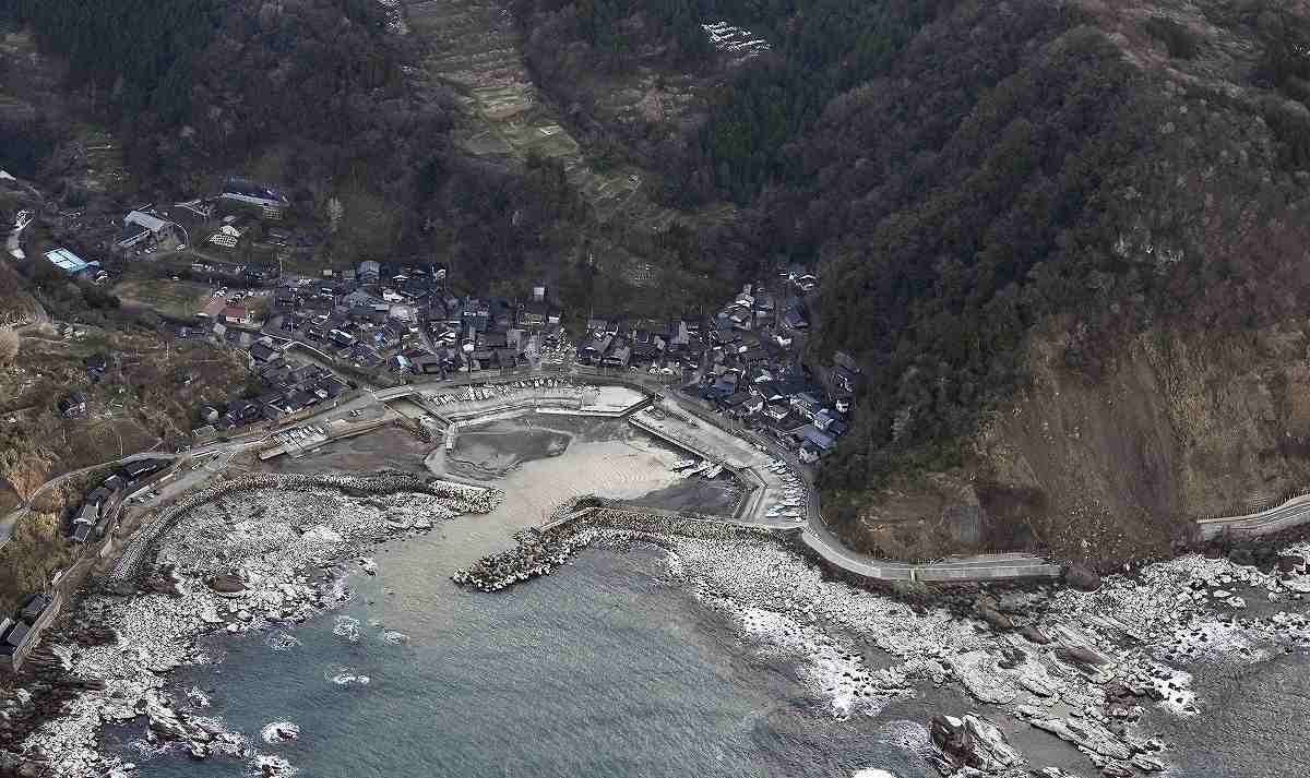
Yomiuri Shimbun file photo A difficult to reach area is seen in Wajima, Ishikawa Prefecture, following the Jan. 1 Noto Peninsula Earthquake.
The Yomiuri Shimbun
20:00 JST, March 30, 2024
The government will start operating a system in April to gather information on disaster damage from the central and local governments, as well as electric power and telecommunications companies among others. The information will be made available to about 1,900 organizations.
Until recently, only the central ministries and agencies could use the system due to technical restrictions.
Under the new system, local governments and businesses are expected to be able to efficiently collect information, helping them provide rapid assistance to areas that are difficult to reach and promptly restore infrastructure, which had become an issue in the aftermath of the Noto Peninsula earthquake.
The government introduced the Integrated Disaster Management Information System in fiscal 2011. The aim was to gather information such as harm to humans, property damage, traffic disruptions and power and water outages from local governments and businesses to display the data on digital maps for helping rescue and relief efforts.
While the system can collect comprehensive information, entering the data is mainly conducted by Cabinet Office personnel. In addition to having time-consuming procedures, it is available only to central government ministries and agencies due to the dedicated governmental circuit lines used in the system, making it difficult to access. As a result, the effective utilization of the system has remained an issue. Due to these circumstances, information in the system was not readily available to those affected by the Jan. 1 earthquake.
To resolve these issues, the central government has decided to shift to the new system in April. The new system can receive relevant data directly from designated public entities, such as power and telecommunications companies, as well as prefectural and municipal governments, allowing them to view the information. The types of data to be entered into the system will increase to include videos taken by cameras installed near rivers and on drones. For areas subject to Japan Meteorological Agency warnings, the system will overlay evacuation information and other relevant information such as road closures onto an image.
“Affected municipalities will be able to identify areas that are flooded or collapsed by using satellite images on the new system, which will be used to help rapid rescue efforts and relief operations,” said a Cabinet Office official.
Expansion eyed for FY26
The government plans to make the information gathered by the new system available to private companies that distribute disaster information to the public as early as fiscal 2026. It aims to make the information more accessible to evacuees, people who have difficulty returning home and support organizations for affected people.
The government is also working to build a system that will distribute information on the situation in disaster-affected areas to the public via smartphones.