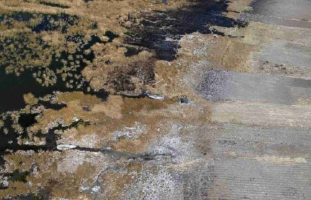
Aerial view of Lake Titicaca is seen in the community of Huatajata in the Bolivian Altiplano on Aug. 9.
16:41 JST, September 8, 2023
HUARINA, Bolivia (AFP-Jiji) — Pedro de la Cruz stood beside his stranded boat and supplicated his God, lifting his arms and praying anxiously for rain to replenish Lake Titicaca, the massive body of water at a breath-sapping altitude in the Andes on the border between Bolivia and Peru.
“Dear God, make more rain come,” the 74-year-old said, invoking Pachamama, Mother Earth for Indigenous people of the region. “Help us, please, we are parched here … Make the rain showers come … Father in heaven, have pity.”
De la Cruz, a former state employee, spoke in Aymara, his native language, as he surveyed what was once the shore of Lake Titicaca, some 77 kilometers west of the capital La Paz.
The waters of Lake Titicaca are within 25 centimeters of their all-time low, a record set in 1996, the chief forecaster for Bolivia’s weather service (Senhami), Lucia Walper, told AFP.
Along what was once the 1,127-kilometer shoreline of the lake, one now sees boats stranded on dry land and orphan docks stretched over nonexistent water.
Low levels mean that fish that ordinarily spawn near shore are now unable to, and that leads Edwin Katari, a 43-year-old fisherman, to mull a question.
“So where are the fish going to spawn?” Katari asked.
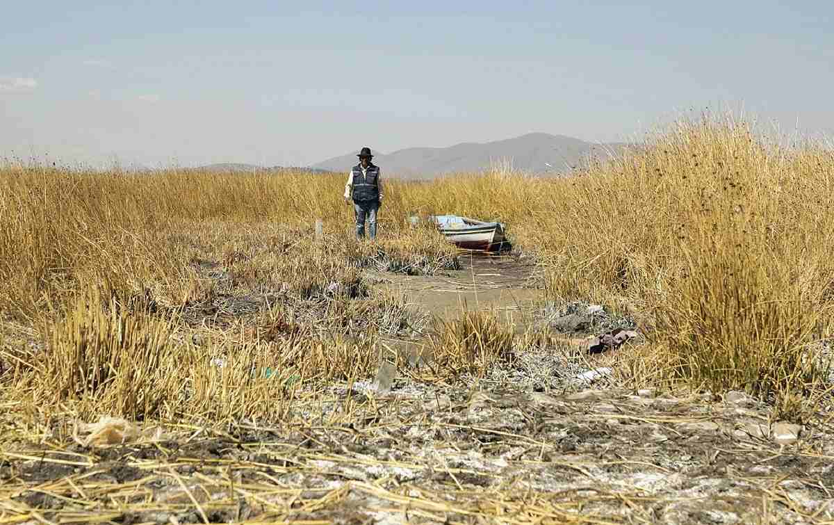
Local resident Pedro de la Cruz walks along a now-dried area of Lake Titicaca.
Dark forecast
Bolivia’s Senhami has measured water levels of the lake since 1974.
At its highest point in 1986, water levels reached 3.7 meters higher than they are today, topping out at 3,811 meters above sea level. But in 1996, they had fallen to 3,807 meters above sea level.
Walper said falling water levels are “the result of climate change” and the outlook is not good.
“It is very probable that they keep falling until they hit even lower levels,” she said.
A satellite survey still has not been made to see how much Lake Titicaca, which once had a surface area of 8,300 square kilometers, has shrunk.
It is the highest of the world’s large lakes and is one of the largest in South America, after Venezuela’s Lake Maracaibo (which is actually connected to the Caribbean Sea) and Brazil’s Lagoa dos Patos, a coastal lagoon.
La Nina and El Nino
The level of Lake Titicaca “has been progressively decreasing due to many meteorological, hydrological and climatic factors,” explained Walper, who emphasizes that “there is less rainfall.”
“Over the years, each phenomenon, whether El Nino and/or La Nina, has been presenting a distortion in its parameters and factors,” she points out, explaining the characteristics of these events — associated with rains or droughts — over time.
The rainfall and the inflow to the lake from Peruvian rivers “were not sufficient to generate the normal rises in times of rain,” she said.
El Nino is a natural climatic event, generally associated with increased temperatures, drought in some parts of the world, and heavy rains in others. La Nina, on the other hand, causes the opposite effects, particularly a drop in temperatures.
Other stresses impact the lake. It is heavily polluted by waste from the city of El Alto, a metropolis of one million people in this landlocked country. Additionally, indiscriminate fishing has decimated species.
Despair sets in
Because the decline in water levels is linked to climate change, the solution “is a global issue,” Walper added.
The recent summit in Brazil of the Amazon Cooperation Treaty Organization reaffirmed the call for industrialized countries to fulfill their promises of economic resources to finance actions against climate change.
But in the villages around Lake Titicaca, despair has set in that water levels will never return to normal in the world’s highest navigable sea.
“If there is no water, if there is no rain, we will not be able to live,” fretted De la Cruz.

Most Read
Most read in the last 24 hours
-

Shifts Startup Focus to Nurturing Global Winners
-
Princess Aiko Enjoys Imperial Court Music, Dance; Production, Cos...
-

Mother Supports My Sister Too Much, Gives Her Kids Much More Than...
-

Bibimbap with Spring Vegetables and Asari Clam Miso a Rich Taste ...
-

Umami History: Kyoto Chef Murata Worked to Share Japan’s Scientif...
-

Appeal of Japanese Food: Make Good Use of ‘Discoveries’ by People...
-

Okinawa Gubernatorial Election: Candidates Should Advocate Realis...
-

Official App to Help Startups Meet Other Participants
Most read in the last 7 days
-
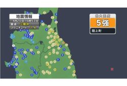
Earthquake Hits Japan's Tohoku Region; 3-meter Tsunami Warning Is...
-

China, South Korea Object to Japanese PM Takaichi's Ritual Offeri...
-

Trump Extends the Ceasefire with Iran but Keeps the Blockade
-

India's Arms Indigenization Quest for Self-Reliance / New Delhi S...
-

¥1,000 Coins to Be Issued to Mark Anniversary of Beginning of Jap...
-

Most Serious Cyberattacks against the UK Now from Russia, Iran an...
-

Trump Opposes United–American Merger, Signals Support for Spirit
-
System Malfunction in Haneda Airport Causes 83 Flight Cancelation...
Most read in the last 30 days
-
Earthquake Hits Japan's Tohoku Region; 3-meter Tsunami Warning Is...
-

Police Find Child's Shoe During Search for Missing Boy in Nantan,...
-
Body Found in Nantan, Kyoto Prefecture, During Search for 11-Year...
-
China, South Korea Object to Japanese PM Takaichi's Ritual Offeri...
-

Cherry Blossoms, Rapeseed Flowers Perform Colorful ‘Duet’ in Niig...
-
Trump Extends the Ceasefire with Iran but Keeps the Blockade
-

Olympic Gold Medal-Winning Figure Skaters Riku-Ryu Announce Retir...
-

Japanese Prime Minister Takaichi Speaks to Pakistani Prime Minist...
Top Articles in Science & Nature
-

Govt Aims to Establish Bear Population Control by FY30, Hopes to Achieve ‘Coexistence’ with Bears
-

Japan’s Panasonic Develops Automated System to Produce Ips Cells from Patient’s Blood
-

Punch The Monkey Getting Used to Life Without Stuffed ‘Mother’
-

‘Electric Aircraft’ to Begin Test Flights from Kitakyushu Airport, Aiming for Practical Use in Cargo Transport Route
-

New Robotics Center to Conduct Experiments Around the Clock; New Facility Aims to Accelerate Research Efforts
JN ACCESS RANKING
-
Earthquake Hits Japan’s Tohoku Region; 3-meter Tsunami Warning Issued (Update 1)
-
Police Find Child’s Shoe During Search for Missing Boy in Nantan, Kyoto Prefecture
-
Body Found in Nantan, Kyoto Prefecture, During Search for 11-Year-Old Boy in Area (Update 1)
-
China, South Korea Object to Japanese PM Takaichi’s Ritual Offering to Yasukuni Shrine
-
Cherry Blossoms, Rapeseed Flowers Perform Colorful ‘Duet’ in Niigata
Most read in the last 24 hours
-
Shifts Startup Focus to Nurturing Global Winners
-
Princess Aiko Enjoys Imperial Court Music, Dance; Production, Cos...
-
Mother Supports My Sister Too Much, Gives Her Kids Much More Than...
-
Bibimbap with Spring Vegetables and Asari Clam Miso a Rich Taste ...
-
Umami History: Kyoto Chef Murata Worked to Share Japan’s Scientif...
Most read in the last 7 days
-
Earthquake Hits Japan's Tohoku Region; 3-meter Tsunami Warning Is...
-
China, South Korea Object to Japanese PM Takaichi's Ritual Offeri...
-
Trump Extends the Ceasefire with Iran but Keeps the Blockade
-
India's Arms Indigenization Quest for Self-Reliance / New Delhi S...
-
¥1,000 Coins to Be Issued to Mark Anniversary of Beginning of Jap...
Most read in the last 30 days
-
Earthquake Hits Japan's Tohoku Region; 3-meter Tsunami Warning Is...
-
Police Find Child's Shoe During Search for Missing Boy in Nantan,...
-
Body Found in Nantan, Kyoto Prefecture, During Search for 11-Year...
-
China, South Korea Object to Japanese PM Takaichi's Ritual Offeri...
-
Cherry Blossoms, Rapeseed Flowers Perform Colorful ‘Duet’ in Niig...