Aomori Trail Walk Winds through Fields and Pines, Bathed in Sea Breeze; Path Reaches Down to Fukushima Pref.

People walk along the Osuka Coast in Hachinohe, Aomori Prefecture, on Sunday, as part of a Michinoku Coastal Trail walk.
17:02 JST, May 28, 2024
Flocks of black-tailed gulls wing through the air, gather on rock faces, and rest themselves on the bows of small fishing boats. Called “umineko” (sea cats) in Japanese, their feline cries echo without stop in Kabushima. The former island, now connected by land to the rest of Hachinohe, Aomori Prefecture, is known as the largest breeding ground for the gulls in Japan. The Michinoku Coastal Trail walk that was held on Sunday started at the seaside park next to Kabushima.
-

Kabushima Shrine on the former island of Kabushima, known as a breeding ground for black-tailed gulls
-

Black-tailed gulls rest on a small fishing boat.
-

A sign for the Michinoku Coastal Trail on Kabushima


A walking enthusiast myself, I joined the 8-kilometer-long course, one of two courses offered that day. And with the sea breeze blowing up on me, I soaked up the greenery.
Michinoku means Tohoku region in Japanese. Though only 8 kilometers long, the course was varied and never dull. The first section is paved in some places and not in others, and passed several small fishing ports. The middle of the trail was an almost straight stretch of sandy beach for around 2.3 kilometers, before it wound through a pine forest along the ocean. The final leg offered a wide-open view, and the finish line was at the end of a grassy field that also serves as a campsite.
-

The opening ceremony is held with Pokemon mascots.
-

The opening ceremony for the trail walk is held with Kabushima in the background.
-

The opening ceremony is held with Pokemon mascots.
-

Locals wave fishermen’s flags near the starting point to see off the walkers.
-

TV personality Ourin, center, walks the Michinoku Coastal Trail on Sunday. (The Yomiuri Shimbun)


After the opening ceremony, I started walking with about 150 other people on the long-distance course. This was no competition. There were many families with small children and everyone walked at their own pace while enjoying the scenery. Just after the start, locals waved fisherman’s flags to us along the road, seeing us off.
The weather was very fine, and made for a perfect walk. The crystal of the ocean reflected the sun, and you could see clear to the horizon. It was a balmy 23 C. As I walked, I grew a little warmer and drew a sweat, but then the sea breeze felt cool and nice.
-

A woman harvests wakame seaweed.
-

A view of the trail soon after the walk’s start
-

Walkers go up a slope
-

The view from the top of a hill


The trail went on for a while without much change in elevation. Sometimes the path was narrow and unpaved and just wide enough for a single person to walk, but then it also crossed the large parking lot of the fishing port. Along the way, I saw a woman harvesting wakame seaweed on the beach and passed a fisherman coming up out of the sea. This is everyday life in Hachinohe. After a while, I climbed a slope and came to the top of a hill from which I could get a good view. Nearby was the Ashigezaki Viewpoint, the starting point for the 5-kilometer course. From there, I enjoyed a 360-degree panoramic view of the area. It reminded me of the Cape of Good Hope in South Africa, where I worked as a correspondent in Africa.
-

Walkers take commemorative photos at the top of the hill
-

A lighthouse on high ground
-

The Ashigezaki Viewpoint
-

The 360-degree view from the Ashigezaki Viewpoint
-

People walk down from the Ashigezaki Viewpoint on Sunday, on the Michinoku Coastal Trail. (The Yomiuri Shimbun)
-

The trail going away from the Ashigezaki Viewpoint
-

Nakasuka, where you can spot a variety of flowers
-

Signposts are placed along the trail.


After that, I passed through Nakasuka, where the fields are home to both seaside and highland flowers, and then on to Osuka Beach, a stretch of white sand. The sand here was heavily eroded by the tsunami brought by the Great East Japan Earthquake 13 years ago. Now it has regained its beauty, and the only sound is the quiet lapping of waves. The sand is known to be squeaky if stepped on when dry, but the walkers found it difficult to cross and walked where it was a little wet, closer to the surf.
-

A store near the beach
-

Osuka Beach
-

Participants walk along the edge of the surf.
-

A signpost along the trail


About 90 minutes in, the trail entered Yodo-no-Matsubara, a pine forest on the final stage of the trail. The trail weaves through many tall pine trees and is shaded and cool. Many oddly shaped rocks stand between the pines, making it one of the most spectacular viewpoints. On my right, on somewhat higher ground, a diesel train of the JR Hachinohe Line passed by. Then the pines ended, and there stretched out a grassy open space that ran all the way down to the water’s edge. Finally, I reached the course’s end at the Tanesashi Coast Information Center, just over two hours after starting.
-

The Seino family joined the walking event and reached the finish line.
-

A variety of oddly shaped rocks can be seen along the trail.
-

The trail in the Yodo-no-Matsubara pine grove
-

The Tanesashi Natural Lawn in the course’s final section
-

A sign at the Tanesashi Coast


One walker, Yuka Seino, did the course with her husband and two elementary school-age children. “We joined from Hachinohe, but this was the first time we walked here,” she said after finishing. “It was really nice to walk slowly while enjoying the scenery.”
The course only covered a small part of the Michinoku trail. The path continues on to Soma for about 1,000 kilometers. Matsuo Basho, a haiku poet of the Edo period (1603-1867), traveled north on foot from what is now Tokyo to Matsushima in Miyagi Prefecture and then Hiraizumi in Iwate Prefecture. Someday I would like to walk the entire Michinoku trail to Soma, as if following Basho’s trip in reverse.
■ For more information, visit the English website of the Michinoku Coastal Trail of the Environment Ministry.
https://tohoku.env.go.jp/mct/english/


Most Read
Popular articles in the past 24 hours
-

Japan Defense Agency to Develop AI Intelligence Analysis System f...
-
Moai Statue Shows Lasting Bond Between Miyagi Pref. Town, Easter ...
-
Milano Cortina 2026: Japan’s Oguri Wins Para Snowboard Silver at ...
-
Japan's Defense Ministry: North Korea Appears to Have Fired Balli...
-
Aichi Fisheries Cooperatives Use Smart Tech to Farm Triploid Oyst...
-
Teachers Support Students’ Inquiry Learning behind the Scenes
-

Japan's Lower House Passes Budget Proposal; Could Be Delayed in U...
-

National Intelligence Council: Proposed Body Must Be Utilized To ...
Popular articles in the past week
-
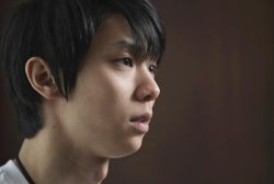
Japan Figure Skating Legend Yuzuru Hanyu Is Proud Disaster Surviv...
-
Govt to Utilize ODA for Ensuring Economic Security; Securing Ener...
-
15 Measles Patients Confirmed in Tokyo in Past 6 Days; 1 May Have...
-
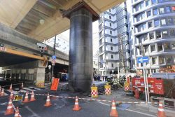
Massive Sewer Pipe Found Jutting Out of Highway in Osaka
-

Japan Govt to Tighten Requirements to Receive Permanent Residency...
-
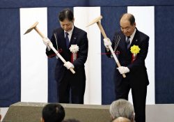
JR Tokai Breaks Ground on Yamanashi Maglev Station; Will Be Part ...
-
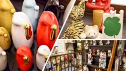
Beckoning Cats Get Makeover to Fit Modern Lifestyles with Sleek D...
-
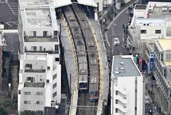
Power Outage Forces About 980 Passengers in Yokohama to Walk to T...
Popular articles in the past month
-
Producer Behind Pop Group XG Arrested for Cocaine Possession
-

Japan PM Takaichi’s Cabinet Resigns en Masse
-

Man Infected with Measles Reportedly Dined at Restaurant in Tokyo...
-

Videos Plagiarized, Reposted with False Subtitles Claiming ‘Ryuky...
-
Japan Figure Skating Legend Yuzuru Hanyu Is Proud Disaster Surviv...
-

iPS Treatments Pass Key Milestone, but Broader Applications Far f...
-

Sanae Takaichi Elected Prime Minister of Japan; Keeps All Cabinet...
-

Nepal Bus Crash Kills 19 People, Injures 25 Including One Japanes...
Top Articles in JN Specialities
-

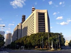
Step Back in Time at Historical Estate Renovated into a Commercial Complex in Tokyo
-

The Japan News / Weekly Edition (2/20-2/26)
-
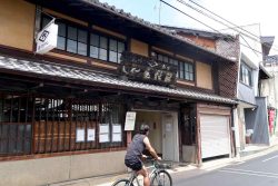
‘World’s Oldest Bio-Business’ Is Japan’s Seed Koji Retailing, Mold Used to Make Fermented Products like Sake, Miso, Soy Sauce
-
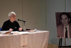
Donald Keene’s Drinking Buddy and Translator Yukio Kakuchi Pays Tribute to Japanologist’s Lifelong Work
-
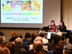
“The Tale of Genji” Back-Translation Project Led to Touching Encounter with Keene; Poet Sisters Recount Memories of Scholar at Packed Talk Event in Tokyo
JN ACCESS RANKING
-
Producer Behind Pop Group XG Arrested for Cocaine Possession
-
Japan PM Takaichi’s Cabinet Resigns en Masse
-
Man Infected with Measles Reportedly Dined at Restaurant in Tokyo Station
-
Videos Plagiarized, Reposted with False Subtitles Claiming ‘Ryukyu Belongs to China’; Anti-China False Information Also Posted in Japan
-
Japan Figure Skating Legend Yuzuru Hanyu Is Proud Disaster Survivor and Gold Medalist, Vows to Continue Support Efforts