Local Fishermen Feel Impact of Forest Fires in Iwate Prefecture; Sea Urchin Season Delayed
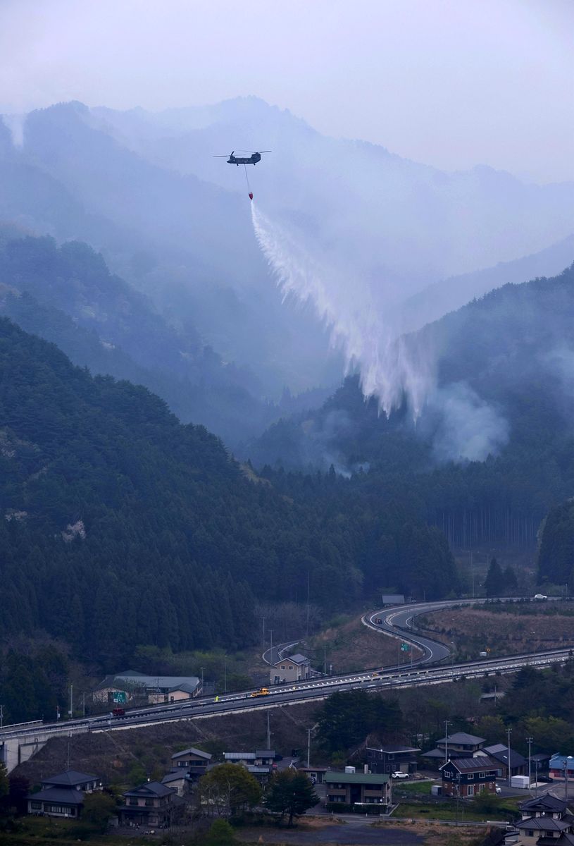
A Self-Defense Force helicopter dumps water as part of firefighting activities in Otsuchi, Iwate Prefecture, on Monday.
17:13 JST, April 27, 2026
OTSUCHI, Iwate — The prolonged forest fires in the town of Otsuchi, Iwate Prefecture, are starting to impact its fishing industry, a key pillar of the regional economy.
The sea urchin season, which was originally scheduled to begin Monday, has been postponed. Many people engaged in the business are currently taking refuge at evacuation shelters, with others assisting firefighting efforts as volunteer firefighters. With no clear timeline for the resumption of fishing, people in the industry are growing increasingly frustrated.
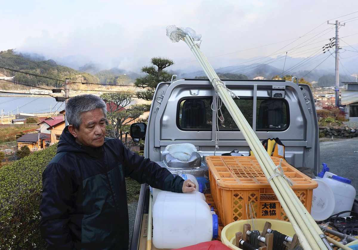
Shigeki Fujiwara loads equipment for catching sea urchins onto his truck on Friday.
“While the containing the fires takes priority, I can’t help but wonder when I can start fishing,” said Shigeki Fujiwara, a 67-year-old fisherman from the town’s Kirikiri district.
The town’s sea urchin season normally starts in late April and runs through around August, and it is a big source of revenue for the fishermen.
During the season, Fujiwara and his wife normally ship 3 to 4 kilograms of sea urchin meat for sale daily. Fujiwara’s sea urchins have earned a good reputation for their rich taste.
As the price of sea urchins has been increasing in recent years, the postponement of the catching season would certainly be a blow to Fujiwara. “I can’t help that the catching season is delayed, but the more it is delayed, the more my revenue will be affected,” Fujiwara said.
One of the forest fires almost reached his home, and Fujiwara moved nets and cages used to catch sea urchins to a relative’s house on Friday. He also had his family take refuge at his wife’s parent’s home to wait for the fires to be brought under control.
“I’m uneasy as the direction the fire spreads depends on the direction of the wind. I hope the wind just stops blowing,” Fujiwara said.
Burning spots visualized
The Yomiuri Shimbun
A professor at the University of Tokyo has created a 3D map that shows the spread of the fires in Otsuchi, Iwate Prefecture. He has launched a website (https://otsuchi.mapping.jp) where the map can be viewed.
Prof. Hidenori Watanabe created the map based on satellite data of heat sources available from NASA. An expert on information design, he has incorporated the heat source data as well as other data such as wind speed and direction on the map. With the wind option toggled on, direction is shown using arrows, with the speed also displayed.
The timeline begins on Wednesday afternoon, and heat sources are shown by dots. The dots start red and gradually fade to yellow, clearly showing the progression of the blazes. It shows that the forest fires have mainly been spreading during the night.
“Since changes to the burning areas and wind direction can be tracked, the map can be used to predict where the fires will spread,” Watanabe said.


Most Read
Most read in the last 24 hours
-

Tokyo Vice Governor: SusHi Tech Tokyo Garners Tangible Business O...
-

Iran's Top Diplomat Briefly Returns to Pakistan but Trump Says th...
-

Japan to Host Leaders from Major Cities from Around the World for...
-

DC Gala Shooting Suspect Aired Grievances against Trump in Writin...
-

Sabastian Sawe of Kenya Becomes First Person to Run a Sub-2-hour ...
-
M6.1 Earthquake Hits Hokkaido, Japan; No Tsunami Expected
-

Students’ ‘ITAMAE’ Project Boosts Interest in Starting Small Busi...
-

Japanese Police Storm Bus to Arrest Man with Knife; No Injuries R...
Most read in the last 7 days
-

China, South Korea Object to Japanese PM Takaichi's Ritual Offeri...
-

Trump Extends the Ceasefire with Iran but Keeps the Blockade
-

India's Arms Indigenization Quest for Self-Reliance / New Delhi S...
-

¥1,000 Coins to Be Issued to Mark Anniversary of Beginning of Jap...
-

Most Serious Cyberattacks against the UK Now from Russia, Iran an...
-

Trump Opposes United–American Merger, Signals Support for Spirit
-

System Malfunction in Haneda Airport Causes 83 Flight Cancelation...
-

Florida Launches Criminal Probe into OpenAI and ChatGPT over Dead...
Most read in the last 30 days
-
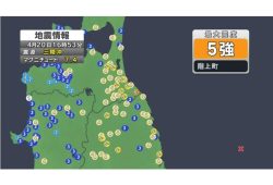
Earthquake Hits Japan's Tohoku Region; 3-meter Tsunami Warning Is...
-

Police Find Child's Shoe During Search for Missing Boy in Nantan,...
-
Body Found in Nantan, Kyoto Prefecture, During Search for 11-Year...
-
China, South Korea Object to Japanese PM Takaichi's Ritual Offeri...
-

Cherry Blossoms, Rapeseed Flowers Perform Colorful ‘Duet’ in Niig...
-
Trump Extends the Ceasefire with Iran but Keeps the Blockade
-

Olympic Gold Medal-Winning Figure Skaters Riku-Ryu Announce Retir...
-

Japanese Prime Minister Takaichi Speaks to Pakistani Prime Minist...
Top Articles in Society
-
Earthquake Hits Japan’s Tohoku Region; 3-meter Tsunami Warning Issued (Update 1)
-
Police Find Child’s Shoe During Search for Missing Boy in Nantan, Kyoto Prefecture
-
Body Found in Nantan, Kyoto Prefecture, During Search for 11-Year-Old Boy in Area (Update 1)
-
Cherry Blossoms, Rapeseed Flowers Perform Colorful ‘Duet’ in Niigata
-

Japan to Ban Use of Portable Chargers on Airplanes from April 24, Number of Regular Chargers To Be Limited to 2
JN ACCESS RANKING
-
Earthquake Hits Japan’s Tohoku Region; 3-meter Tsunami Warning Issued (Update 1)
-
Police Find Child’s Shoe During Search for Missing Boy in Nantan, Kyoto Prefecture
-
Body Found in Nantan, Kyoto Prefecture, During Search for 11-Year-Old Boy in Area (Update 1)
-
China, South Korea Object to Japanese PM Takaichi’s Ritual Offering to Yasukuni Shrine
-
Cherry Blossoms, Rapeseed Flowers Perform Colorful ‘Duet’ in Niigata
Most read in the last 24 hours
-
Tokyo Vice Governor: SusHi Tech Tokyo Garners Tangible Business O...
-
Iran's Top Diplomat Briefly Returns to Pakistan but Trump Says th...
-
Japan to Host Leaders from Major Cities from Around the World for...
-
DC Gala Shooting Suspect Aired Grievances against Trump in Writin...
-
Sabastian Sawe of Kenya Becomes First Person to Run a Sub-2-hour ...
Most read in the last 7 days
-
China, South Korea Object to Japanese PM Takaichi's Ritual Offeri...
-
Trump Extends the Ceasefire with Iran but Keeps the Blockade
-
India's Arms Indigenization Quest for Self-Reliance / New Delhi S...
-
¥1,000 Coins to Be Issued to Mark Anniversary of Beginning of Jap...
-
Most Serious Cyberattacks against the UK Now from Russia, Iran an...
Most read in the last 30 days
-
Earthquake Hits Japan's Tohoku Region; 3-meter Tsunami Warning Is...
-
Police Find Child's Shoe During Search for Missing Boy in Nantan,...
-
Body Found in Nantan, Kyoto Prefecture, During Search for 11-Year...
-
China, South Korea Object to Japanese PM Takaichi's Ritual Offeri...
-
Cherry Blossoms, Rapeseed Flowers Perform Colorful ‘Duet’ in Niig...