Typhoon Jongdari Moves Slowly Northeast from Japan’s Miyako Island; Heavy Rainfall Expected in Japan’s Okinawa, Southern Kyushu Areas
12:02 JST, August 19, 2024
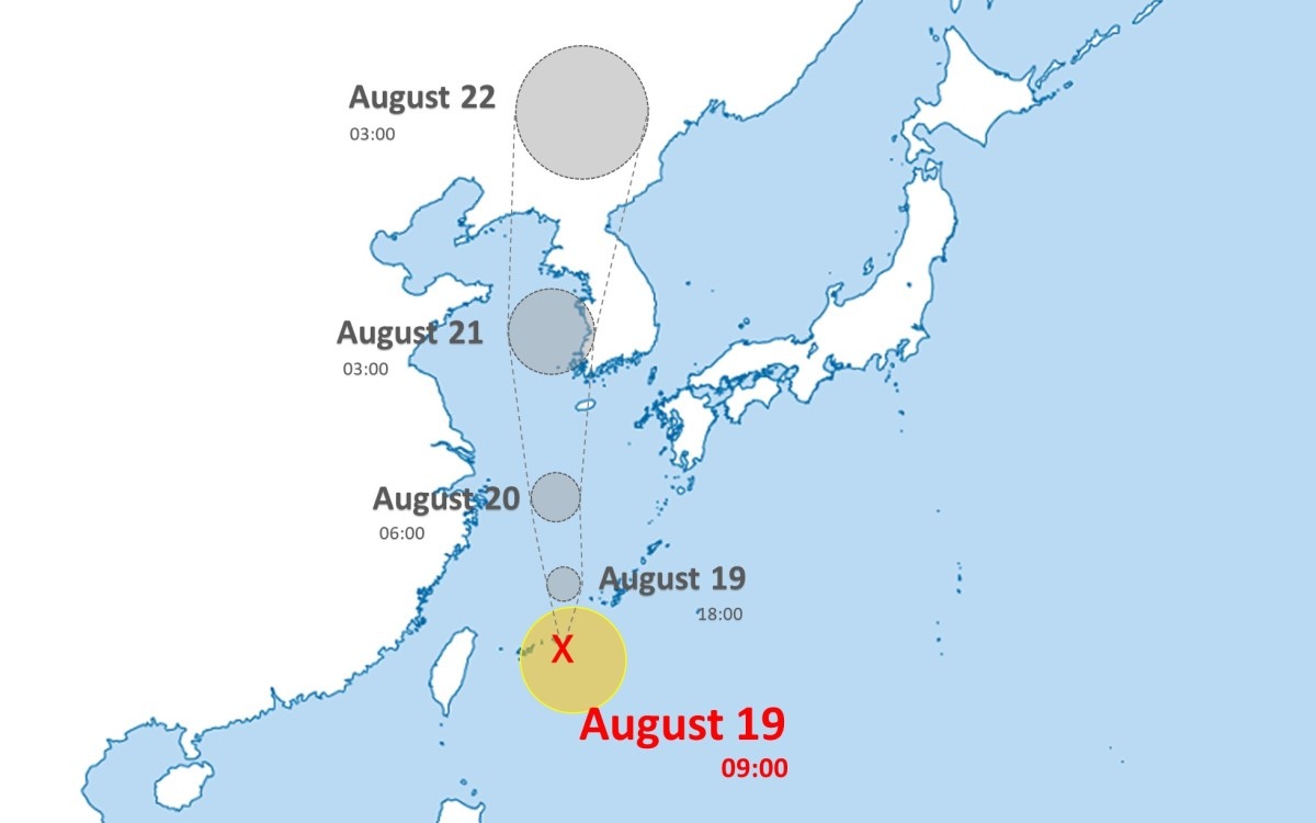
A tropical cyclone about 70 kilometers south of Miyako Island, Okinawa Prefecture, has turned into Typhoon Jongdari, or Typhoon No. 9, according to the Japan Meteorological Agency.
Heavy rainfall is expected on Okinawa’s main island and the Sakishima Islands, as well as southern Kyushu. Local meteorological observatories have issued advisories, urging caution over possible landslides flooding in low-level areas and rising river levels.
As of 9 a.m., the typhoon was moving northeast from the island at about 80 kilometers per hour, with pressure at he center measured at 1,000 hectopascals. It is expected to move northward and continue over the East China Sea through Tuesday.
Related Tags


Most Read
Most read in the last 24 hours
-

Trump Extends the Ceasefire with Iran but Keeps the Blockade
-

China, South Korea Object to Japanese PM Takaichi's Ritual Offeri...
-

Trump Opposes United–American Merger, Signals Support for Spirit
-

Florida Launches Criminal Probe into OpenAI and ChatGPT over Dead...
-

Trump Picks a University of Minnesota Professor to Lead His Econo...
-

Japan's ANA to Introduce Fuel Surcharges to Domestic Flights from...
-

Taiwan President Cancels Africa Trip Blaming Chinese Pressure
-

Fired Former UK Official Says He Felt Political Pressure to Appro...
Most read in the last 7 days
-
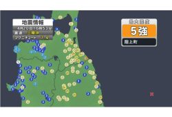
Earthquake Hits Japan's Tohoku Region; 3-meter Tsunami Warning Is...
-
Trump Extends the Ceasefire with Iran but Keeps the Blockade
-

Olympic Gold Medal-Winning Figure Skaters Riku-Ryu Announce Retir...
-
China, South Korea Object to Japanese PM Takaichi's Ritual Offeri...
-

Japan to Ban Use of Portable Chargers on Airplanes from April 24,...
-

New Challenges Await as Miura-Kihara Retires; Blade Maker, Ex-Coa...
-
Trump Opposes United–American Merger, Signals Support for Spirit
-
Florida Launches Criminal Probe into OpenAI and ChatGPT over Dead...
Most read in the last 30 days
-
Earthquake Hits Japan's Tohoku Region; 3-meter Tsunami Warning Is...
-

Police Find Child's Shoe During Search for Missing Boy in Nantan,...
-
Body Found in Nantan, Kyoto Prefecture, During Search for 11-Year...
-

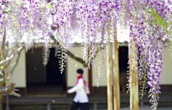
Cherry Blossoms, Rapeseed Flowers Perform Colorful ‘Duet’ in Niig...
-
Trump Extends the Ceasefire with Iran but Keeps the Blockade
-
Olympic Gold Medal-Winning Figure Skaters Riku-Ryu Announce Retir...
-

Nori Prices Surge in Japan Due to Poor Seaweed Production Amid Ri...
-

Japanese Prime Minister Takaichi Speaks to Pakistani Prime Minist...
Top Articles in Society
-
Earthquake Hits Japan’s Tohoku Region; 3-meter Tsunami Warning Issued (Update 1)
-
Police Find Child’s Shoe During Search for Missing Boy in Nantan, Kyoto Prefecture
-
Body Found in Nantan, Kyoto Prefecture, During Search for 11-Year-Old Boy in Area (Update 1)
-
Cherry Blossoms, Rapeseed Flowers Perform Colorful ‘Duet’ in Niigata
-

Two Women in Osaka Found Lying on Floor Bleeding, Later Pronounced Dead
JN ACCESS RANKING
-
Earthquake Hits Japan’s Tohoku Region; 3-meter Tsunami Warning Issued (Update 1)
-
Police Find Child’s Shoe During Search for Missing Boy in Nantan, Kyoto Prefecture
-
Body Found in Nantan, Kyoto Prefecture, During Search for 11-Year-Old Boy in Area (Update 1)
-
Cherry Blossoms, Rapeseed Flowers Perform Colorful ‘Duet’ in Niigata
-
Trump Extends the Ceasefire with Iran but Keeps the Blockade
Most read in the last 24 hours
-
Trump Extends the Ceasefire with Iran but Keeps the Blockade
-
China, South Korea Object to Japanese PM Takaichi's Ritual Offeri...
-
Trump Opposes United–American Merger, Signals Support for Spirit
-
Florida Launches Criminal Probe into OpenAI and ChatGPT over Dead...
-
Trump Picks a University of Minnesota Professor to Lead His Econo...
Most read in the last 7 days
-
Earthquake Hits Japan's Tohoku Region; 3-meter Tsunami Warning Is...
-
Trump Extends the Ceasefire with Iran but Keeps the Blockade
-
Olympic Gold Medal-Winning Figure Skaters Riku-Ryu Announce Retir...
-
China, South Korea Object to Japanese PM Takaichi's Ritual Offeri...
-
Japan to Ban Use of Portable Chargers on Airplanes from April 24,...
Most read in the last 30 days
-
Earthquake Hits Japan's Tohoku Region; 3-meter Tsunami Warning Is...
-
Police Find Child's Shoe During Search for Missing Boy in Nantan,...
-
Body Found in Nantan, Kyoto Prefecture, During Search for 11-Year...
-
Cherry Blossoms, Rapeseed Flowers Perform Colorful ‘Duet’ in Niig...
-
Trump Extends the Ceasefire with Iran but Keeps the Blockade