To use this site, please disable the ad blocking feature and reload the page.
This website uses cookies to collect information about your visit for purposes such as showing you personalized ads and content, and analyzing our website traffic. By clicking “Accept all,” you will allow the use of these cookies.
Users accessing this site from EEA countries and UK are unable to view this site without your consent. We apologize for any inconvenience caused.
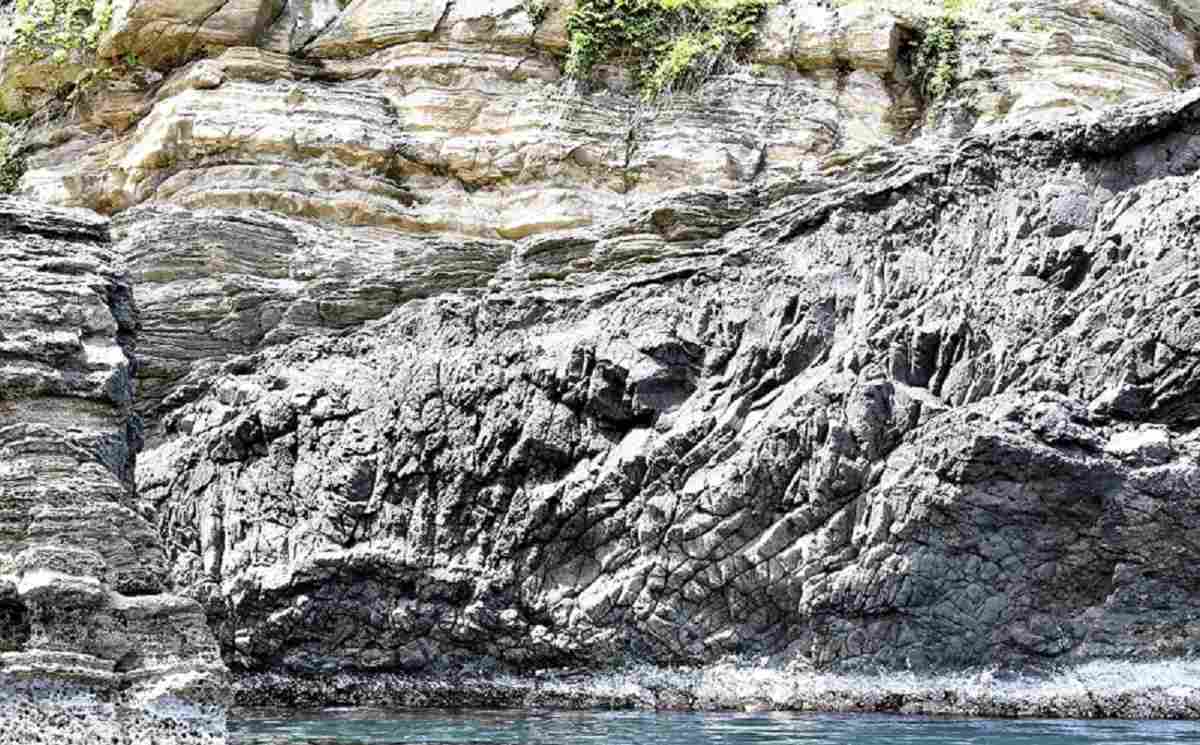
The Yomiuri Shimbun The ocher-colored “wall” section seen here in Shinonsen, Hyogo Prefecture, is believed to have formed 20 million years ago when the Japanese archipelago was cut off from the Eurasian continent.
By Shoichiro Nakai / Yomiuri Shimbun Staff Writer
14:08 JST, May 27, 2023
SHINONSEN, Hyogo — Steep cliffs and other geological formations are helping unlock the secrets of the Japanese archipelago in a UNESCO geopark that stretches from Kyoto to Tottori prefectures along the Sea of Japan coast.
San’in Kaigan Geopark is dotted with rock formations that chronicle the origin and history of the Sea of Japan.
I rode a sightseeing boat from the town of Shinonsen, Hyogo Prefecture, and learned about a “global-scale drama” that unfolded in bygone days.
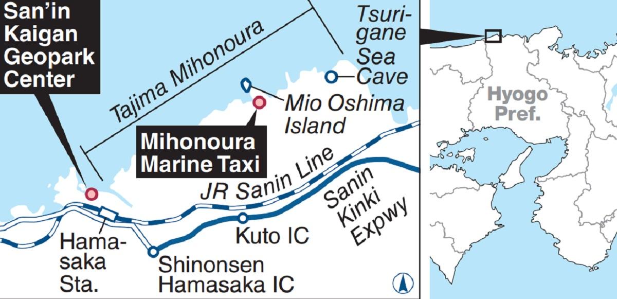
An area stretching from Shinonsen to Kami in the prefecture comprises the scenic site known as Tajima Mihonoura. Shortly after the boat departed Shinonsen, I saw cliffs being pummeled by heavy waves.
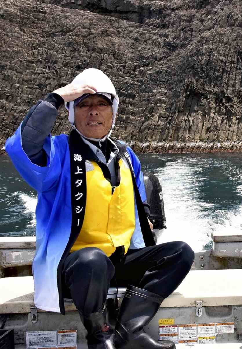
“The area is rich with geological traces,” said Tamotsu Maeda, while operating his about 5-meter-long boat. The 74-year-old fisherman operates an “aquatic taxi” as a side business. Maeda gradually became familiar with the geopark while taxiing experts around, and he and five local residents have for around a decade been operating the Mihonoura Marine Taxi service, guiding tourists around the park. Maeda sails his five- to six-seat boat around the steep cliffs and sea caves while explaining the geology, geological conditions and history of the area.
The Yomiuri Shimbun Tamotsu Maeda is seen in Shinonsen, Hyogo Prefecture, with Mio Oshima Island in the background.
The ocean veteran pointed to an ocher-colored layer in the upper part of a cliff, explaining that it was a stratum of solidified sand and mud — apparent evidence that the Japanese archipelago had been cut off from the Eurasian continent.
“Previously, this was the bottom of a lake that formed when the Japanese archipelago became detached from the continent,” Maeda said. Tree fossils believed to have existed on the continent and subsequently found in the stratum provide evidence for this theory, he explained.
The Japanese archipelago started forming when the eastern edge of the Eurasian continent began breaking up. About 25 million years ago, depressions were created, which later became lakes. As the eastern edge was being severed from the continent, the depressions expanded and gave rise to what would later become the Sea of Japan. The Japanese archipelago was formed some 2.6 million years ago by the elevation of eastern Japan and island movement.
Volcanic rocks around the stratum indicate the existence of volcanic activity, which is believed to have pushed the stratum upward from the bottom of the lake.
Mio Oshima Island, close to Mio Port, offers a magnificent view of vertically cracked rock formations that resemble tightly bound pillars. The entire land mass is thought to comprise such columnar joints, formed from lava extruded from the earth some 3 million years ago.
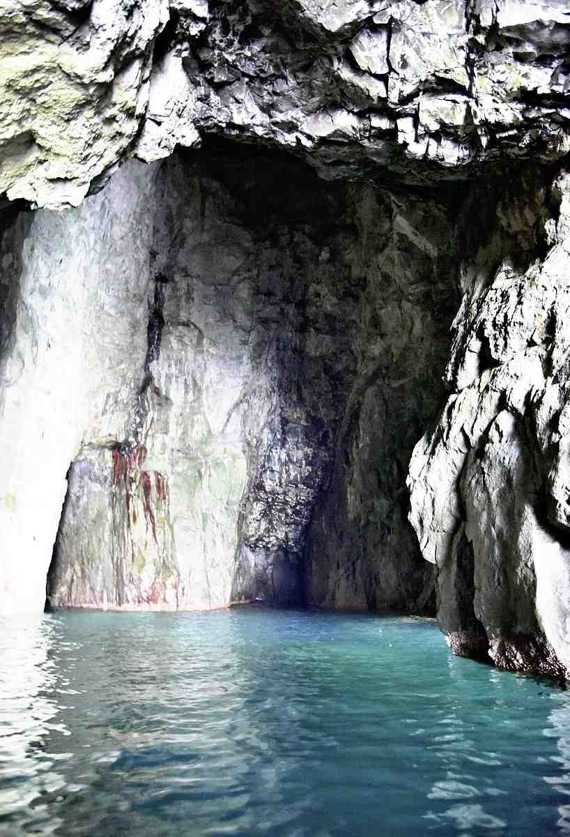
The Yomiuri Shimbun Tsurigane Sea Cave in Kami, Hyogo Prefecture
The entrance to Tsurigane Sea Cave can be found in a steep cliff in Kami, east of the island. “Tsurigane” means temple bell; the cave’s interior has a similar shape. The cave, which is only accessible by small vessels, is the largest of its kind in the geopark.
As the boat sailed through the cave, my eyes gradually adjusted to the darkness, and I began to behold a mysterious and beautiful landscape. The sea was crystal clear in the dim light, with the water reflecting off the rocky surfaces. I felt overwhelmed by the sense of passing time in the rough, wave-wrought space.
“The geologic conditions, nature and history [of the place] are all pretty amazing, right?” Maeda said. I heartily concurred.
Sea of Japan’s history
To get a glimpse into the origin and history of the Sea of Japan, take a trip to San’in Kaigan Geopark Center in Shinonsen.
The facility boasts rocks, minerals and dioramas of the Japanese archipelago that detail the initial formation and history of the Sea of Japan.
Working physical models demonstrate how rivers form, how sand moves and how gravel is deposited, helping visitors understand the land-formation processes that occur under different geological conditions.
“Geographical features come about as a result of the battle between sea and land,” said geomorphology expert Isamu Tanimoto, 79. “It’s fun to imagine those processes.”
The center exhibits volcanic rocks ranging in age from hundreds of millions of years old, when Japan was still part of the continent, to around 20,000 years ago — relatively recently in geological terms. Animal footprint fossils also grab visitors’ attention.
“The geopark tells a wondrous story,” Tanimoto said.
Take a trip!
The Yomiuri Shimbun
Mihonoura Marine Taxi offers an about 90-minute tour that costs ¥6,000 per person or ¥15,000 for a group of five. Business days depend on the weather and sea conditions. Admission to San’in Kaigan Geopark Center is free. It is closed Tuesdays (or the following day if Tuesday falls on a national holiday).